


A poster of the Alta Via 1 Hiking Trail in the Italian Dolomites, Europe. It shows the entire route and an elevation contour map of the Alta Via 1 hiking trail. On the bottom, it also includes an elevation profile, along with key points of interest.
About the Alta Via 1
Alta Via 1, also known as the Dolomites High Route 1, is one of the most renowned long-distance hiking trails in the Italian Alps, running through the heart of the Dolomites, a UNESCO World Heritage site. The route is known for its dramatic scenery, featuring towering limestone cliffs, jagged peaks, alpine meadows rich with flora and fauna, turquoise lakes, and fast-flowing mountain rivers. Despite its popularity, much of the trail feels remote, crossing high passes and rugged terrain. Typically completed in 8–12 days, Alta Via 1 is considered a challenging trek, requiring good fitness, sure-footedness, and comfort with sustained elevation gain. With its combination of wild landscapes, well-maintained paths, and historic mountain refuges, the trail offers a demanding yet deeply rewarding alpine experience.
Statistics About the Alta Via 1
- Start point: Lago di Braies, Italy
- End Point: La Pissa, Italy
- Total distance: 120 km / 75 miles
- Total altitude gain/loss: 6745 m / 22,129 ft
- Highest point: 2752 m / 9029 ft (Rifugio Lagazuoi)
-
Time to finish: Typically 8 to 10 days

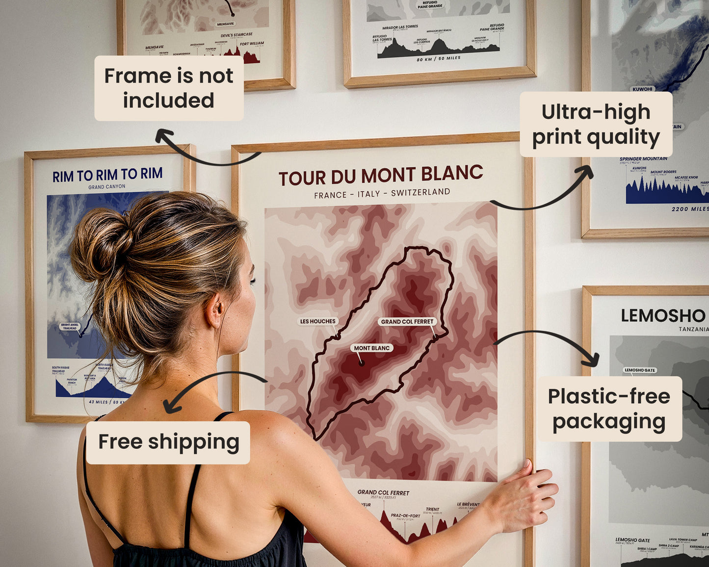
High Quality Matte Prints
Our posters are manufactured using ultra high definition printers with very rich and vivid colors. They're printed on thick, 189 g/m² matte paper sourced from Japan.

Plastic-Free Packaging
Our prints are shipped in cardboard triangles instead of typical tubes. This is better for the enviroment, because no plastic is used in the packaging.

The Right Size & Color for You
Our sizes are offered in imperical and metrical measurements, so it's easier for you to find the right frame locally.

Free Shipping With 2+ Posters
Save money by adding another poster to your cart (maybe as a gift for one of your friends or close relative), and get free shipping, even on international orders.

No Import Fees*
We have fulfillment locations in the United States, Canada, the United Kingdom, Spain, and Latvia. They're always manufactured from the closest one to your shipping address, so you can avoid paying import tax, get quicker deliveries, and reduce your carbon footprint.

30-day Satisfaction Guarantee
If, for whatever reason, you change your mind, we accept returns within 30 days of the delivery date.