Skip to product information
1 of 8

Trail Goals

Camino de Santiago Poster (With Topographic Map)

Camino de Santiago Poster (With Topographic Map)

Regular price €25.00
Regular price Sale price €25.00
Sale Sold out
Shipping calculated at checkout.
Size
Color
  • Our prints are shipped unframed
View full details

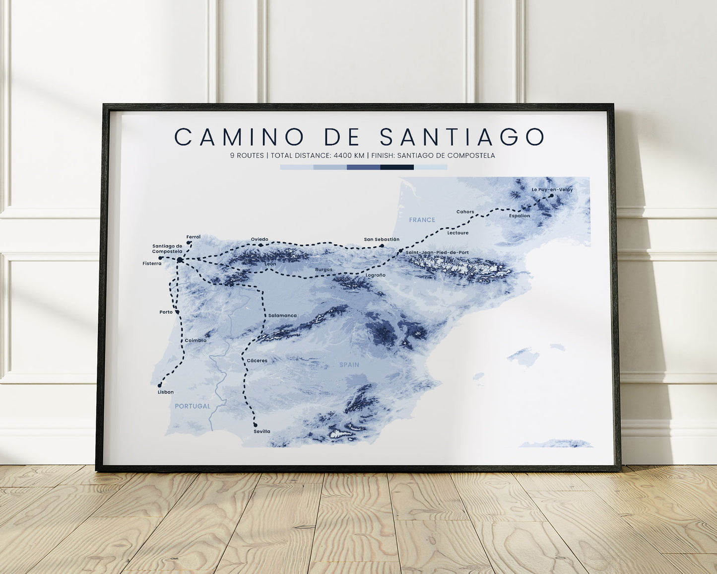
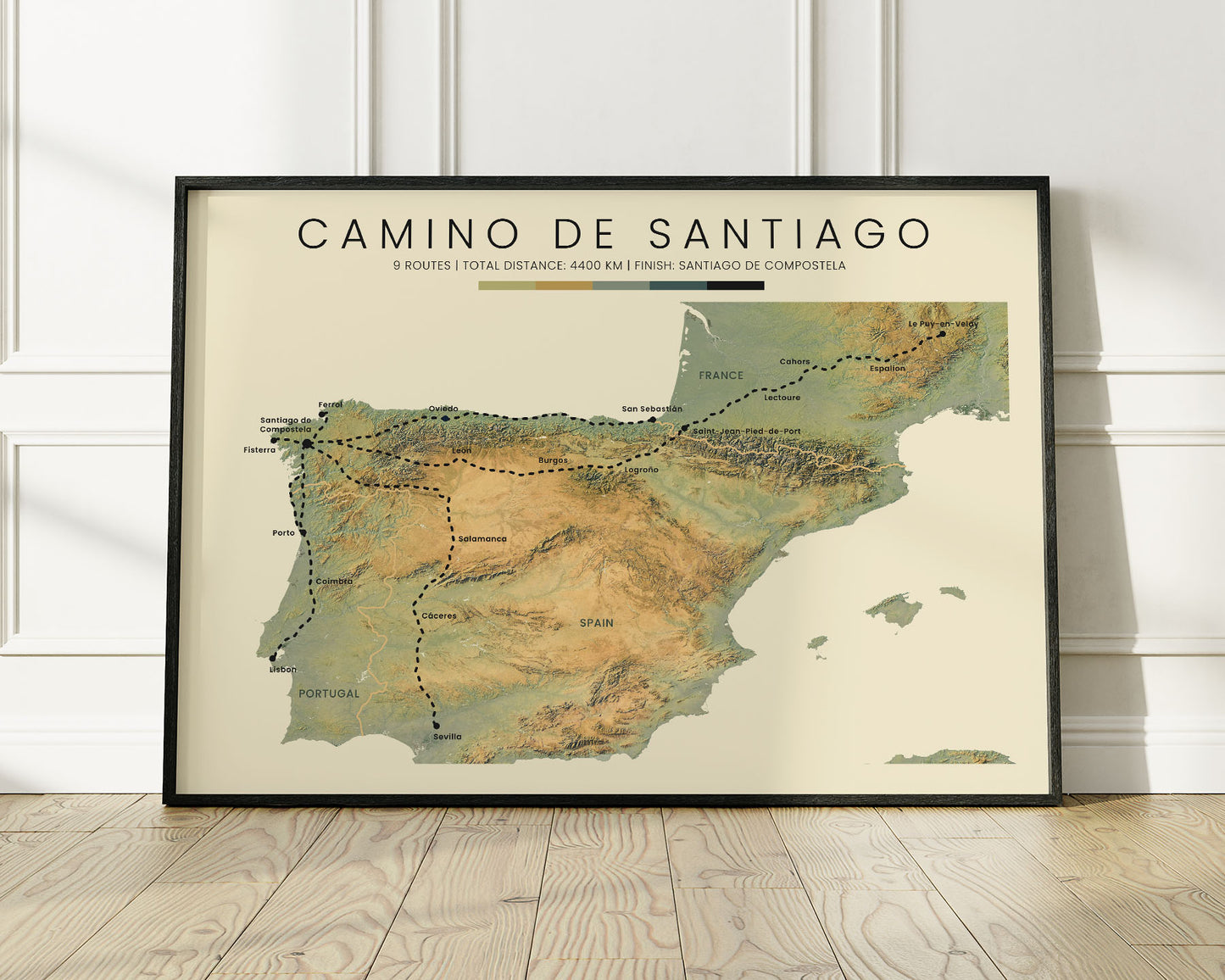
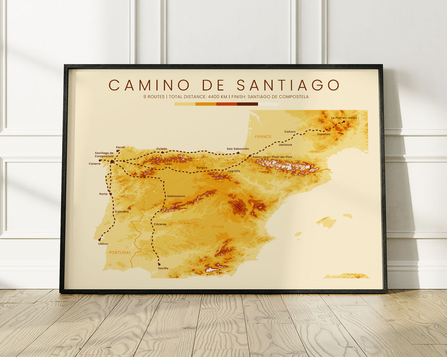
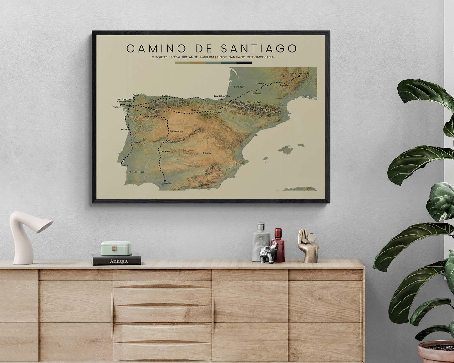
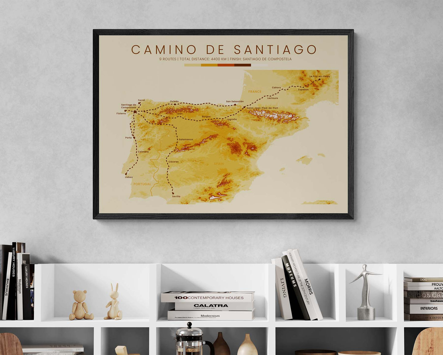
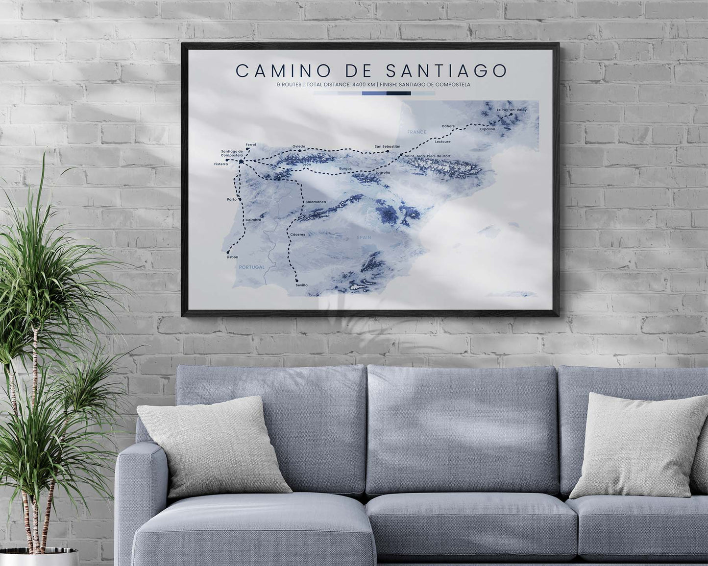
A print that displays a topographic map of the Camino de Santiago Pilgrimage. It shows 9 of the most popular routes: Camino Frances, Camino Finisterre, Camino Ingles, Camino Primitivo, Camino Del Norte, Le Puy Camino, Via De La Plata, Camino Portugues Coastal, and Camino Portugues Central. We've made it using open-source elevation satellite data and then transformed it into beautiful wall art. If you've done one of the Camino de Santiago Pilgrimages and you plan to do other ones, then this poster will offer a great way to keep you on track. It's offered in different color options (minimalistic, vintage, and realistic), to look good in any interior.

About the Camino de Santiago Pilgrimage 

Camino de Santiago is the most popular pilgrimage in the world, also called the Way of Saint James or the Pilgrimage of Compostela. You can start it anywhere in the world, but it always ends at Santiago de Compostela, Spain. Depending on your chosen route, you will experience rural Spain, France, and Portugal, and encounter countless cultural and religious sites.

Important: There are multiple Camino de Santiago Routes. So if you're buying this print as a gift, make sure that you're buying the correct one! You'll find a list of all the routes that we've covered over here.

Statistics About the Camino de Santiago Routes

Camino Finisterre (I)

  • Start point: Fisterra, Spain
  • End point: Santiago de Compastela, Spain
  • Total distance: 90 km / 56 miles
  • Total altitude: 1646 m / 5400 ft
  • Countries Crossed: Spain
  • Regions Crossed: Galicia

Camino Ingles (II)

  • Start point: Ferrol, Spain
  • End point: Santiago de Compastela, Spain
  • Total distance: 121 km / 75 miles
  • Total altitude: 2168 m / 7113 ft
  • Countries Crossed: Spain
  • Regions Crossed: Galicia

Camino Primitivo (III)

  • Start point: Oviedo, Spain
  • End point: Santiago de Compastela, Spain
  • Total distance: 315 km / 196 miles
  • Total altitude: 8199 m / 26 900 ft
  • Countries Crossed: Spain
  • Regions Crossed: Asturias, Galicia

Camino del Norte (IV)

  • Start point: San Sebastian, Spain
  • End point: Oviedo, Spain
  • Total distance: 466 km / 290 miles
  • Total altitude: 9166 m / 39 972 ft
  • Countries Crossed: Spain
  • Regions Crossed: Cantabria, Asturias, Galicia

Camino Frances (V)

  • Start point: Saint-Jean-Pied-de-Port, France
  • End point: Santiago de Compastela, Spain
  • Total distance: 784 km / 487 miles
  • Total altitude: 11 500 m / 37 739 ft
  • Countries Crossed: Spain, France
  • Regions Crossed: Pyrénées-Atlantiques, Navarre, La Rioja, Castilla Y Leon, Galicia

Le Puy Camino (Via Podiensis) (VI)

  • Start point: Le-Puy-en-Velay, France
  • End point:Saint-Jean-Pied-de-Port, France
  • Total distance: 748 km / 465 miles
  • Total altitude: 15 125 m / 49 622 ft
  • Countries Crossed: France
  • Departments Crossed: Haute-Loire, Lozere, Aveyron, Lot, Tarn-et-Garonne, Gers, Landes, Pyrénées-Atlantiques

Via de la Plata (VII)

  • Start point: Seville, Spain
  • End point: Santiago de Compastela, Spain
  • Total distance: 992 km / 616 miles
  • Total altitude: 11 796 m / 38 701 ft
  • Countries Crossed: Spain
  • Regions Crossed: Andalucia, Extremadura, Castilla Y Leon, Galicia

Camino Portugues Coastal (VIII)

  • Start point: Porto, Portugal
  • End point: Santiago de Compastela, Spain
  • Total distance: 270 km / 168 miles
  • Total altitude: 2634 m / 8642 ft
  • Countries Crossed: Portugal, Spain
  • Regions Crossed: Porto, Braga, Viana do Castelo, Galicia

Camino Portugues Central (IX)

  • Start point: Lisbon, Portugal
  • End point: Santiago de Compastela, Spain
  • Total distance: 615 km / 382 miles
  • Total altitude: 7258 m / 23 816 ft
  • Countries Crossed: Portugal, Spain
  • Regions Crossed: Lisboa, Santarem, Leiria, Coimbra, Aveiro, Porto, Braga, Viana do Castelo, Galicia

Frequently Asked Questions

How good is the print quality?

All of our posters are printed on high-quality matte paper, with no reflection/glare and a paper weight of 189 g/m² or higher. This thickness is usually used in premium quality posters because they're more resistant to bending, scratching, and folding.

They're printed on high-definition printers that achieve very rich and vivid colors. We use 100% accurate colors when designing our prints, which means that they'll look very close to what you see on your screen.

Where are your prints manufactured?

We work with many premium print studios all across the world, with manufacturing locations in the United States, Canada, the United Kingdom, Spain, Latvia, Japan, and Australia.

Your print will always be printed and shipped from the nearest location, which means that you won't have to pay any import fees if you live in one of these regions. This also means that they will be delivered more quickly.

How long will it take to deliver it?

Our prints are made-to-order, which means that we don't hold any stock, and that they'll be printed only after you place an order.

If you live in Europe or North America, usually our prints are manufactured and delivered in 5-7 business days.

Our guaranteed delivery times are as follows:

United States, Canada, United Kingdom, and European Union (including EEZ): 12 business days after placing the order.

Everywhere else: 20 business days after placing the order.

Do you ship worldwide, and what are the shipping costs?

Yes, we ship worldwide to almost any country, except for a few sanctioned locations like Russia, Cuba, or North Korea.

Our shipping costs are as follows:

  • United States: 3.50 EUR
  • Canada and European Union: 5 EUR
  • Everywhere else: 10 EUR

If you purchase 2 or more prints, you'll get free shipping!

Can I customize my print?

You can customize any of our hiking prints for a small extra fee. Simply select the "Add customizations" option, and explain your customizations in the text field that shows up.

We can customize any of the statistics and change their titles, change the title or the subtitle, add and remove points of interest on the map, add a quote, display units only in metric or imperial measurements, and do other minor customizations.

If you want to order a print of a completely custom route, purchase our custom hiking trail listing.

Are your posters shipped framed?

Our posters are shipped unframed, rolled up in a cardboard box. You will need to purchase the same separately.

We strongly recommend choosing sizes in imperial measurements (inches) if you're from North America, and metric measurements (cm) if you're from Europe. That's because it's often very hard to find metric-sized frames in North America and vice versa.

To frame the poster, we recommend unrolling it and keeping it flat (with the help of some books or something heavy) for 12 hours. This will make it easier to frame. You may need to cut off a few millimeters using scissors to make the poster fit the frame, because most frames have a rather large margin of error. We recommend cutting from all sides equally to keep the print centered.

Do you accept returns?

We accept returns within 30 days after delivering the order, regardless of the reason.

You'll need to cover the return shipping costs, and after we receive it, we will refund you the full amount.

If, however, your poster arrives damaged, we will replace it free of charge under our warranty.

We don't accept returns for personalized prints.