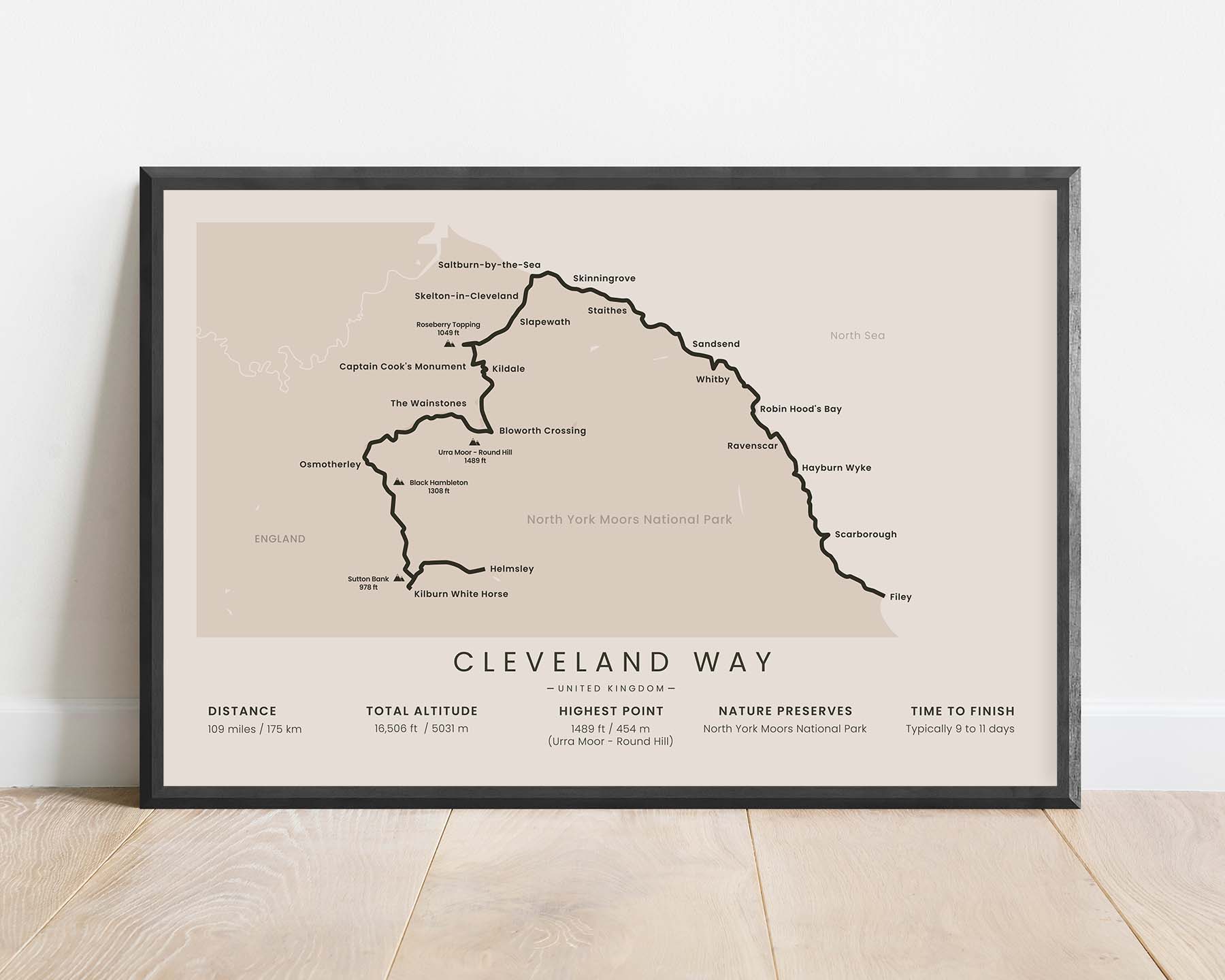
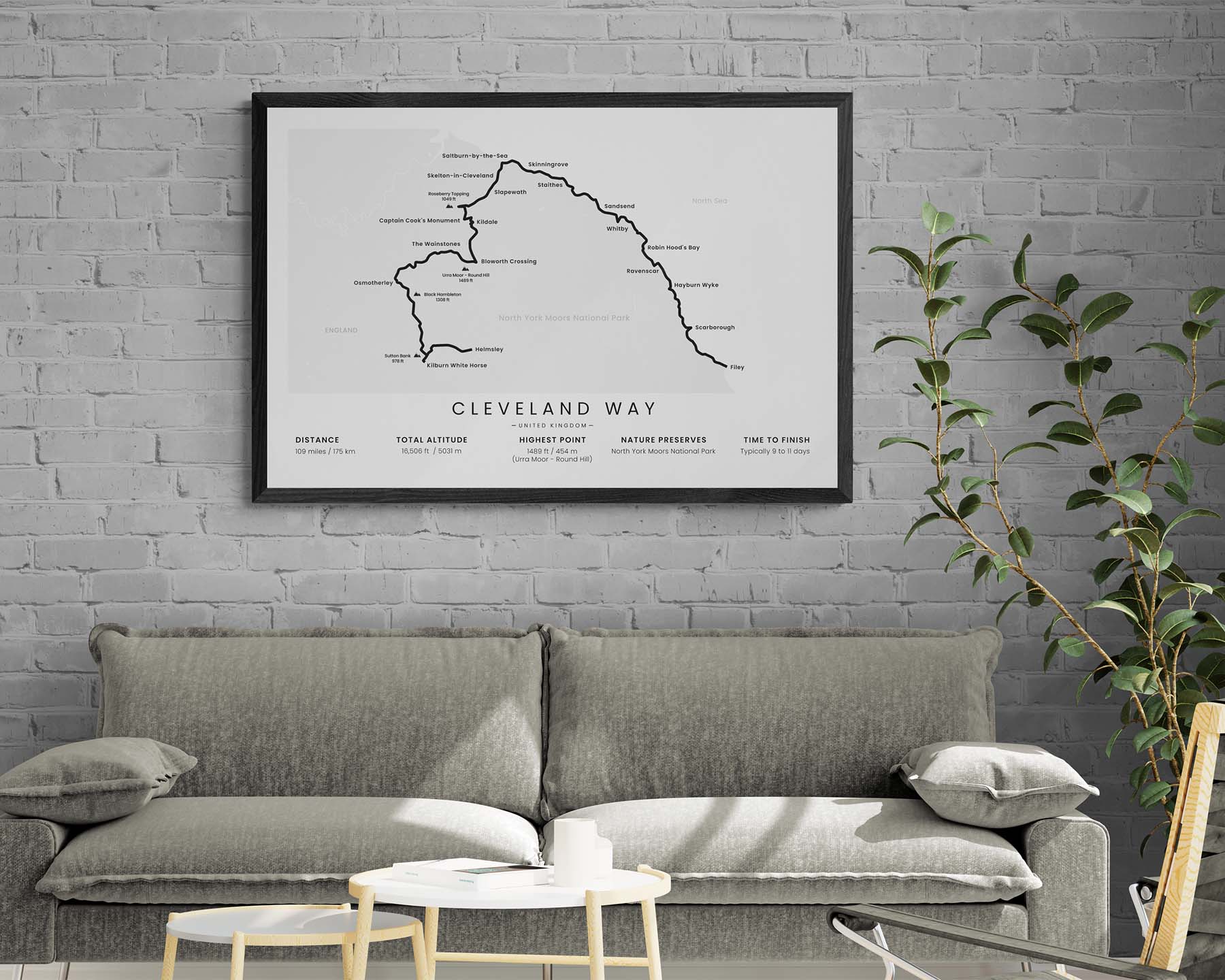
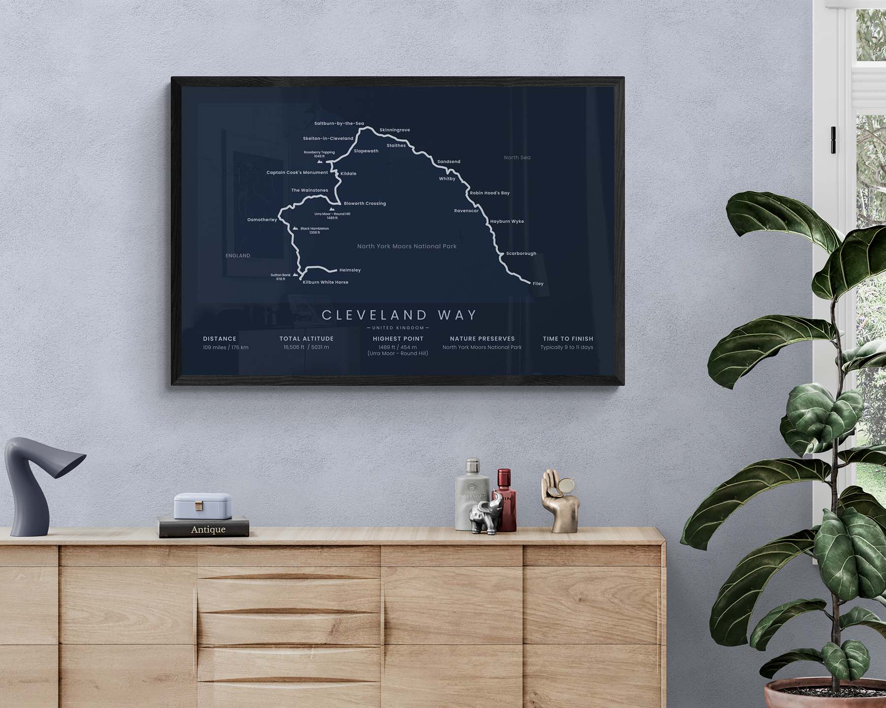


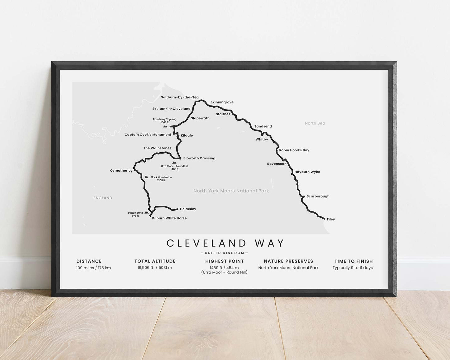
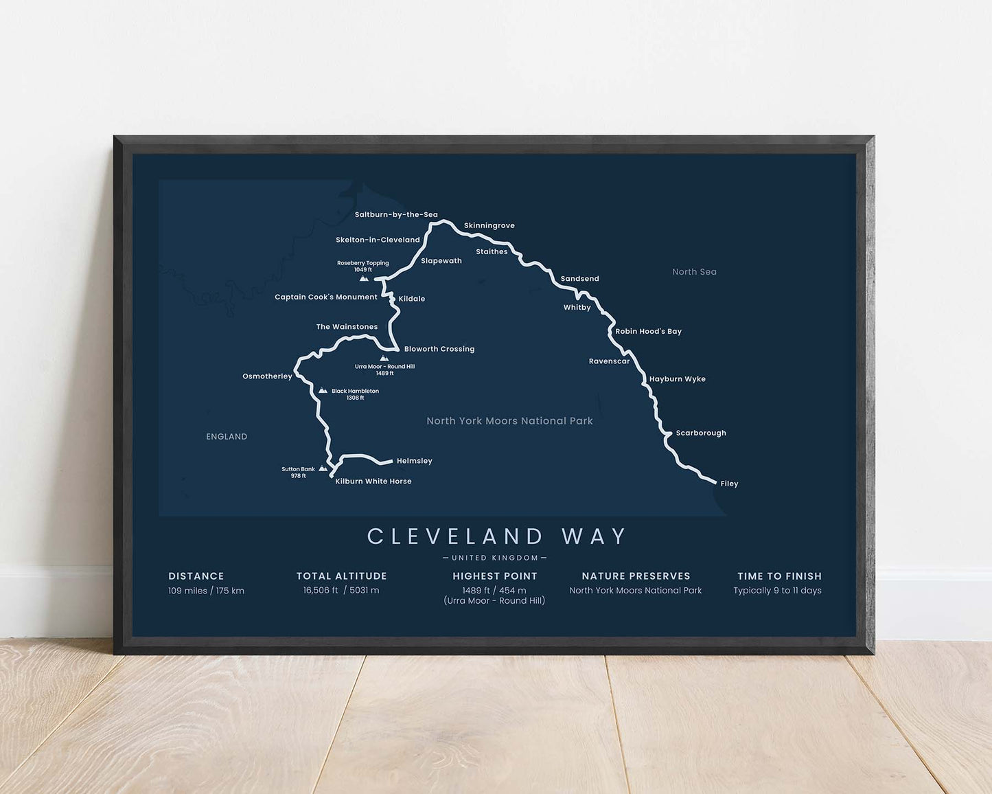
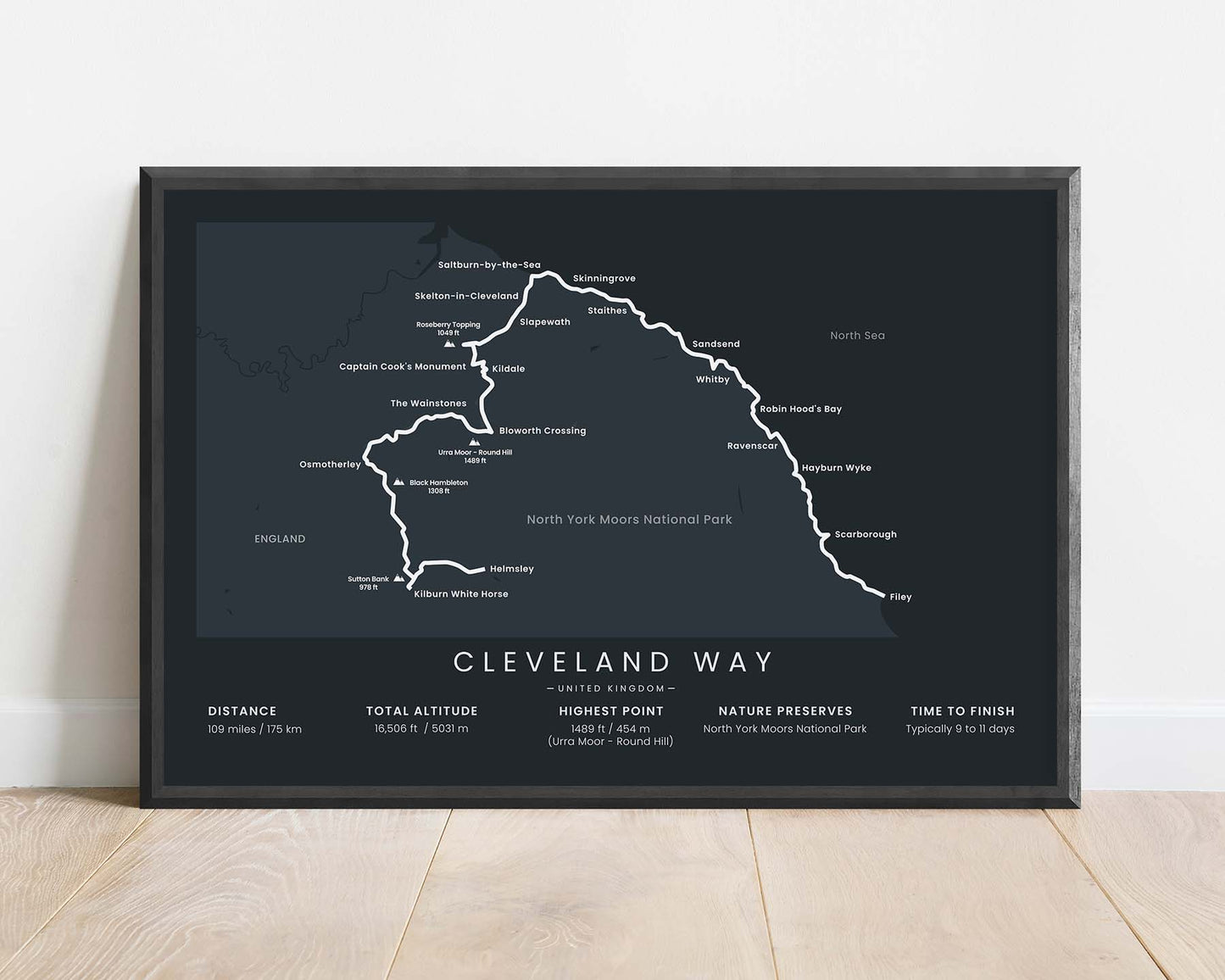
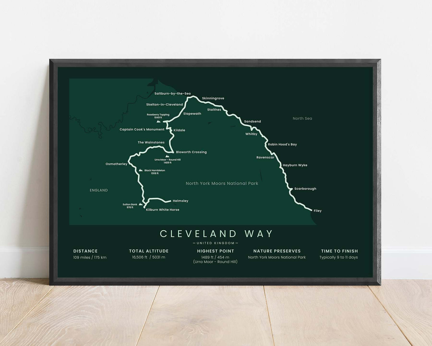
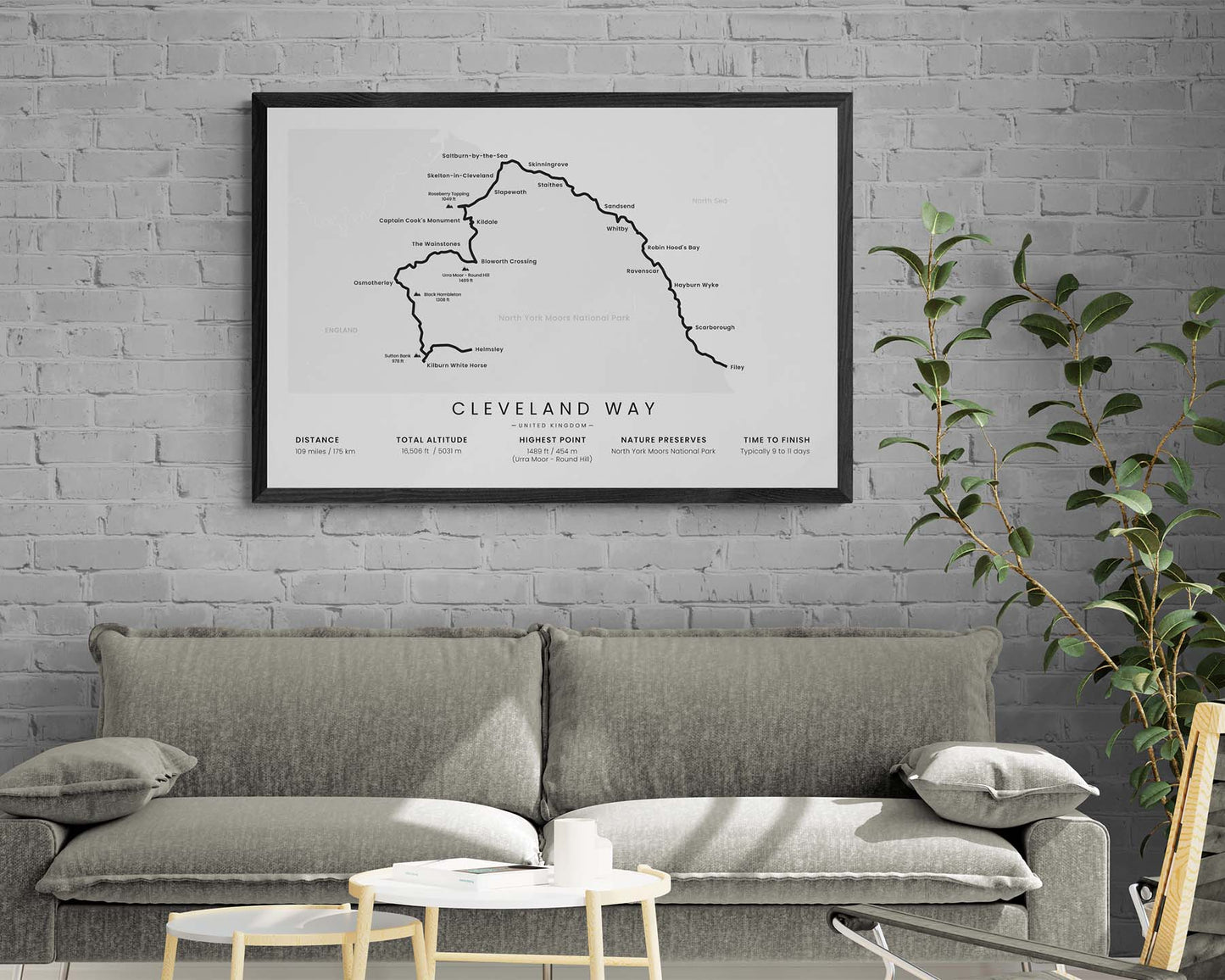

A minimalistic map of the Cleveland Way hiking trail in North Yorkshire, Northern England. It shows the full route of the thru-hike, key cities, points of interest, and hills along the way, and important statistics about the trail at the bottom. It's offered in several different minimal color options and different sizes to look good in any interior.
About the Cleveland Way
The Cleveland Way is a 109-mile-long thru-hike in North Yorkshire, Northern England. It starts at Helmsley, then goes through the North York Moors National Park, joins the coastline at Saltburn-by-the-Sea, and finishes at the coastal town of Filey. It offers a good combination of inland hiking through remote and wild natural areas and coastal hiking with traditional fishing towns and local foods.
Statistics About the Cleveland Way
- Start point: Helmsley, England
- End point: Filey, England
- Total distance: 109 miles / 175 km
- Total altitude gain/loss: 16 506 ft / 5031 m
- Highest point: 1489 ft / 454 m (Urra Moor - Round Hill)
- Countries crossed: England, United Kingdom
- National parks crossed: North York Moors National Park
- Time to finish: Typically 9 to 11 days

High Quality Matte Prints
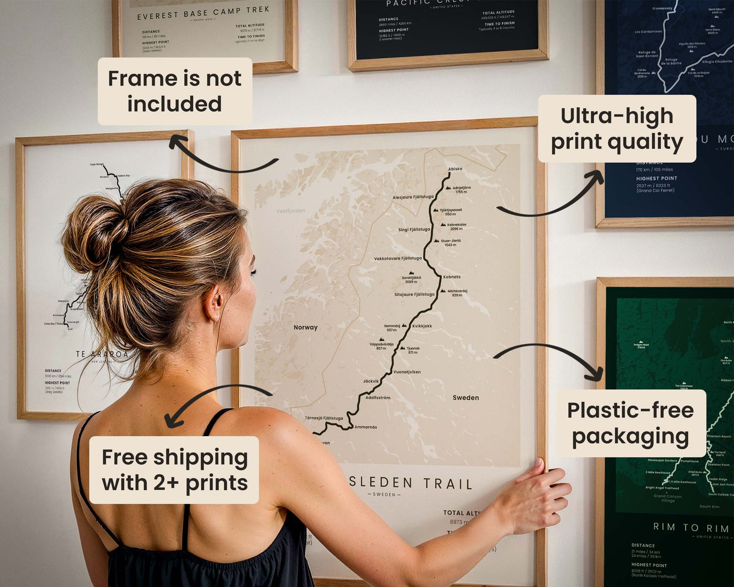
Our posters are manufactured using ultra high definition printers with very rich and vivid colors. They're printed on thick, 189 g/m² matte paper sourced from Japan.

Plastic-Free Packaging
Our prints are shipped in cardboard triangles instead of typical tubes. This is better for the enviroment, because no plastic is used in the packaging.

The Right Size & Color for You
Our sizes are offered in imperical and metrical measurements, so it's easier for you to find the right frame locally.

Free Shipping With 2+ Posters
Save money by adding another poster to your cart (maybe as a gift for one of your friends or close relative), and get free shipping, even on international orders.

No Import Fees*
We have fulfillment locations in the United States, Canada, the United Kingdom, Spain, and Latvia. They're always manufactured from the closest one to your shipping address, so you can avoid paying import tax, get quicker deliveries, and reduce your carbon footprint.

30-day Satisfaction Guarantee
If, for whatever reason, you change your mind, we accept returns within 30 days of the delivery date.