


A print that displays the Everest Base Camp Trek hiking trail. It shows an elevation contour topographic map of Nepal in the background and an elevation profile of the hike at the bottom, along with a few key points of interest.
About the Everest Base Camp Trek
The Everest Base Camp Trek - often called the EBC or Mount Everest Trek - is one of the most iconic trekking routes in the world, located in Nepal’s Himalayan Mountains. Beginning with a flight to Lukla, the trail winds through the Khumbu region to Everest Base Camp at the foot of Mount Everest, the highest peak on Earth. Along the way, trekkers pass through Sherpa villages, cross suspension bridges over deep valleys, and climb gradually through pine forests, alpine terrain, and high mountain passes. The journey offers breathtaking views of legendary peaks such as Everest, Lhotse, Nuptse, and Ama Dablam, as well as a glimpse into the region’s rich Buddhist culture and monasteries. The trek is physically demanding due to altitude, making acclimatization an essential part of the experience.
Statistics About the Mount Everest Trek
- Start point: Lukla, Nepal
- End point: Everest Base Camp, Nepal
- Total distance: 80 miles / 130 km
- Total altitude gain/loss: 32,044 ft / 9676 m
- Highest point: 17,598 ft / 5364 m (Everest Base Camp)
- Countries crossed: Nepal
-
Time to finish: Typically 11 to 14 days

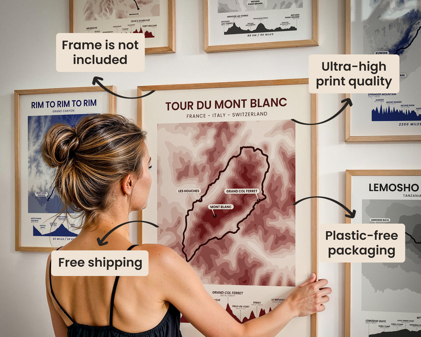
High Quality Matte Prints
Our posters are manufactured using ultra high definition printers with very rich and vivid colors. They're printed on thick, 189 g/m² matte paper sourced from Japan.

Plastic-Free Packaging
Our prints are shipped in cardboard triangles instead of typical tubes. This is better for the enviroment, because no plastic is used in the packaging.

The Right Size & Color for You
Our sizes are offered in imperical and metrical measurements, so it's easier for you to find the right frame locally.

Free Shipping With 2+ Posters
Save money by adding another poster to your cart (maybe as a gift for one of your friends or close relative), and get free shipping, even on international orders.

No Import Fees*
We have fulfillment locations in the United States, Canada, the United Kingdom, Spain, and Latvia. They're always manufactured from the closest one to your shipping address, so you can avoid paying import tax, get quicker deliveries, and reduce your carbon footprint.

30-day Satisfaction Guarantee
If, for whatever reason, you change your mind, we accept returns within 30 days of the delivery date.