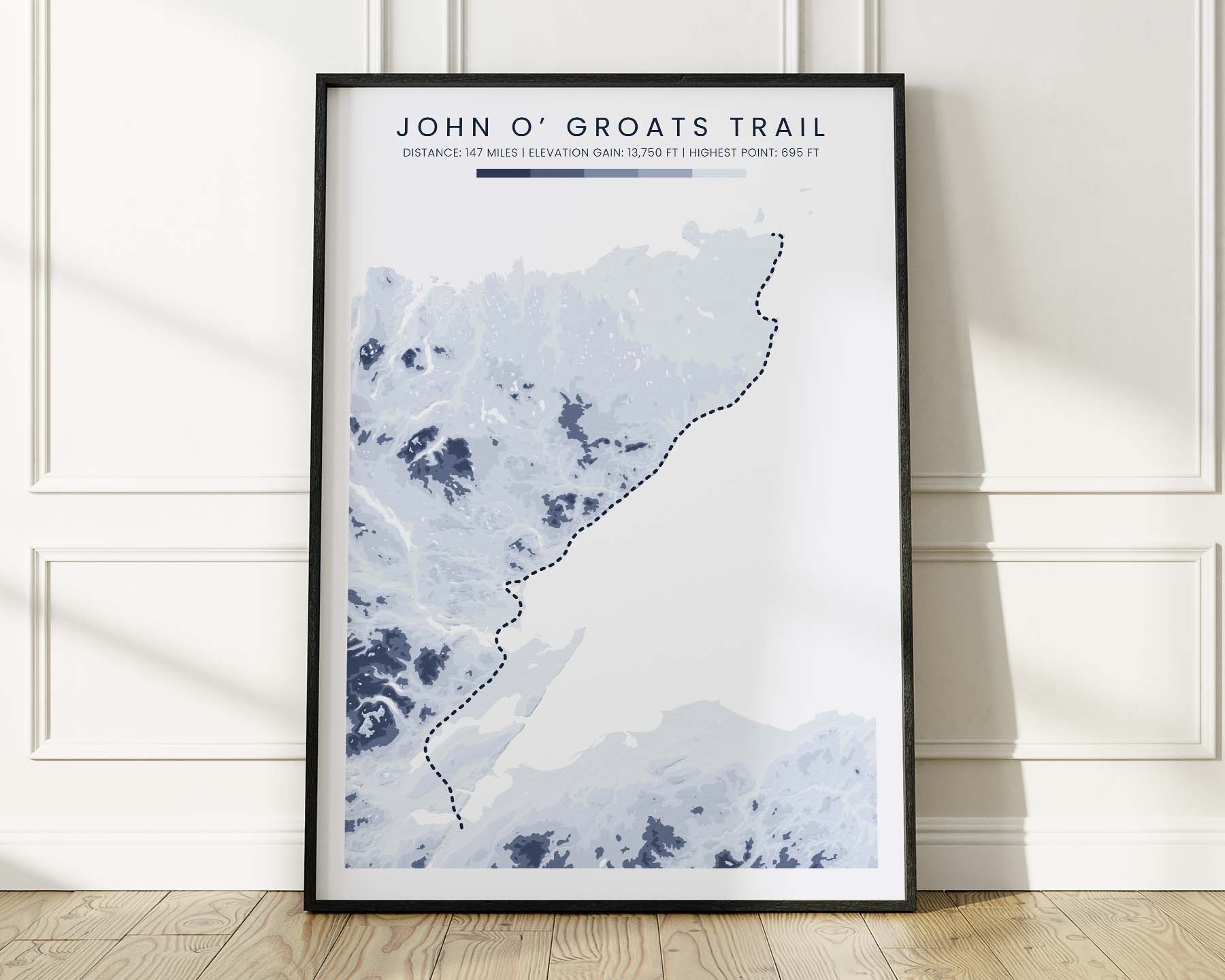

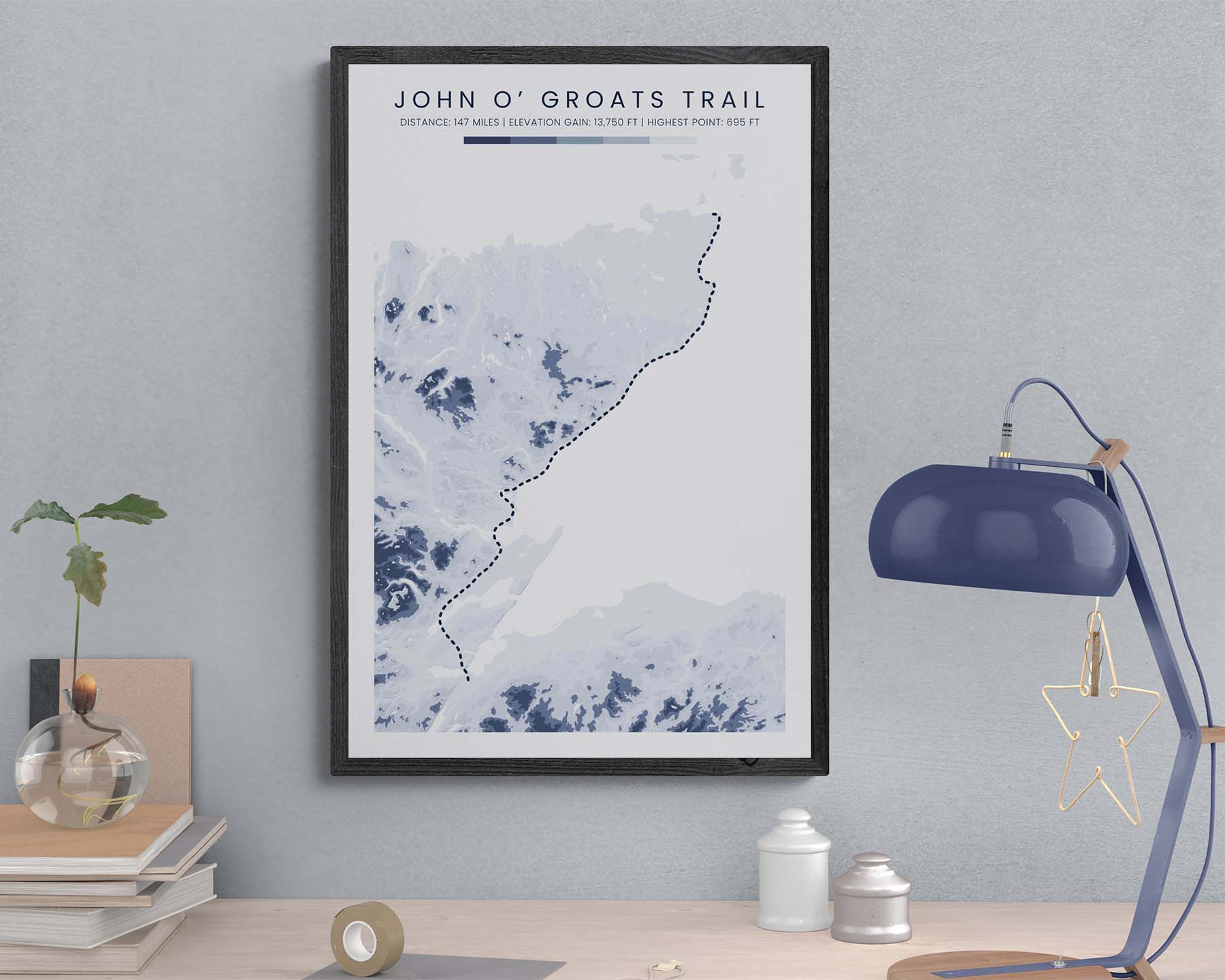
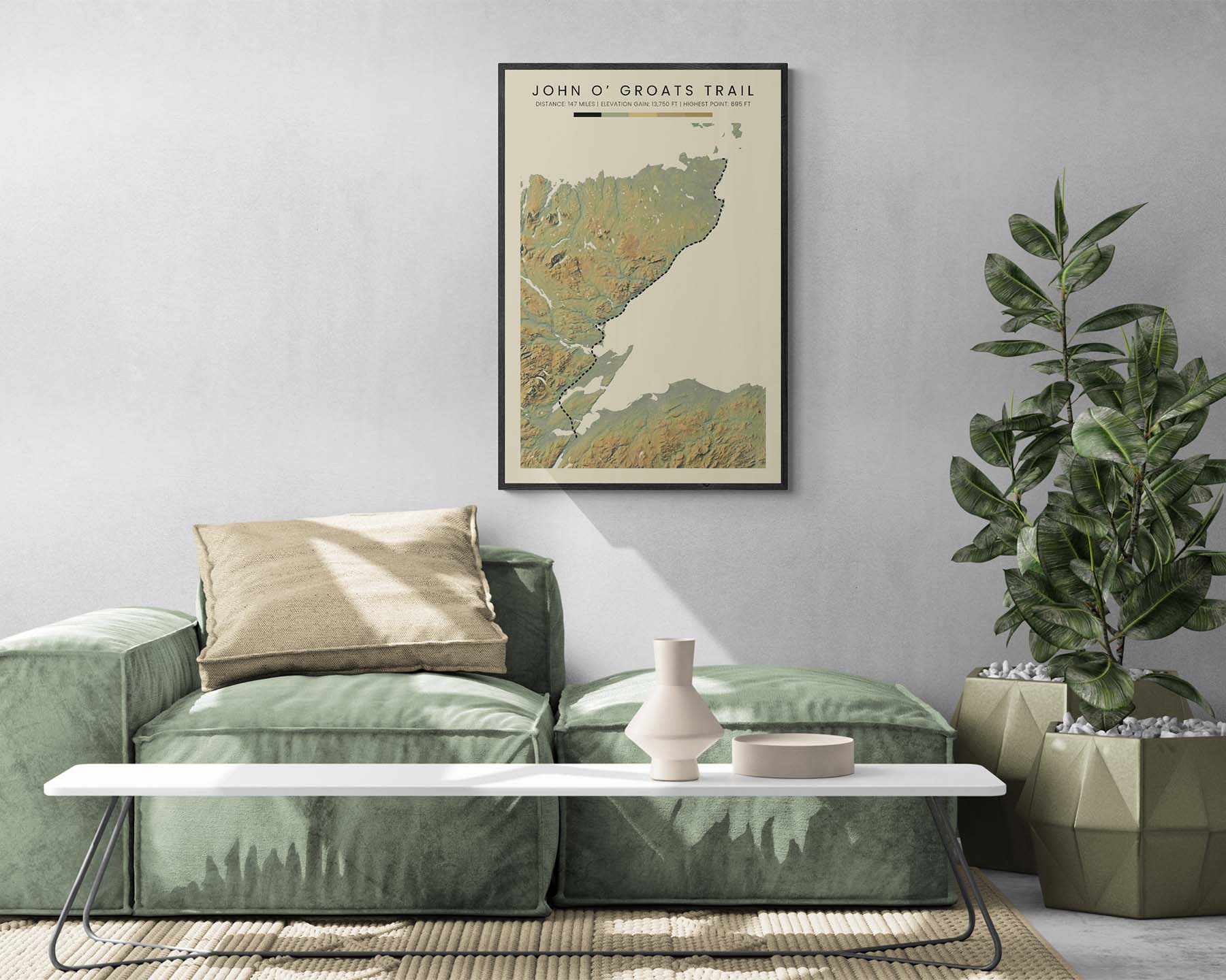

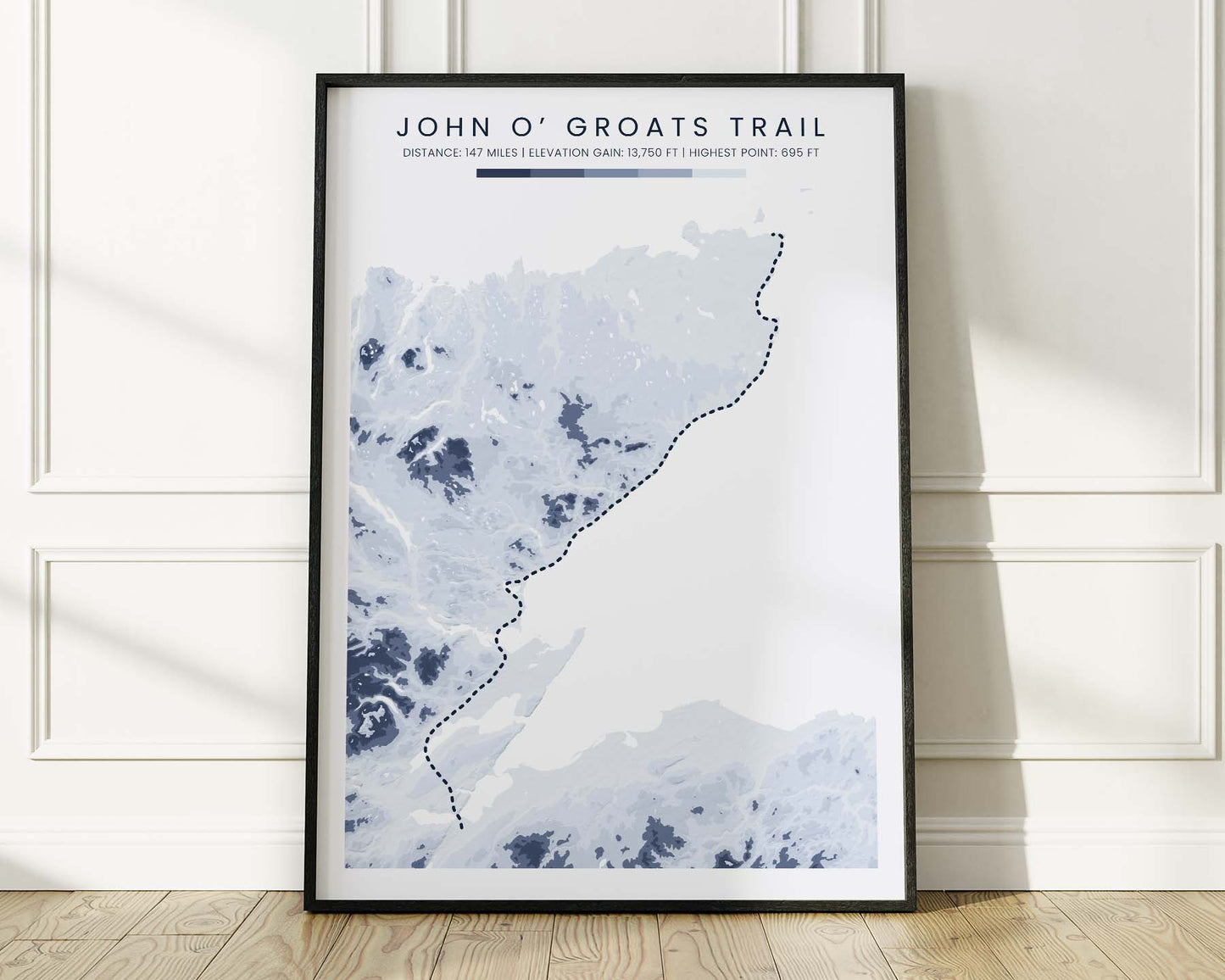
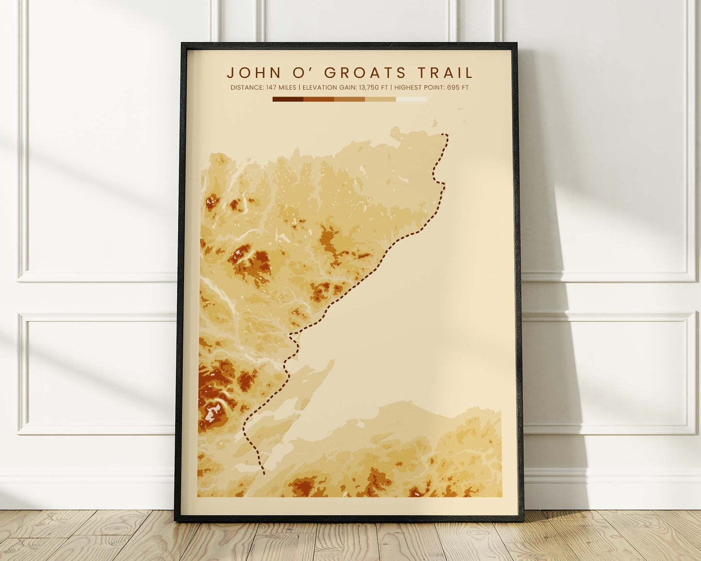
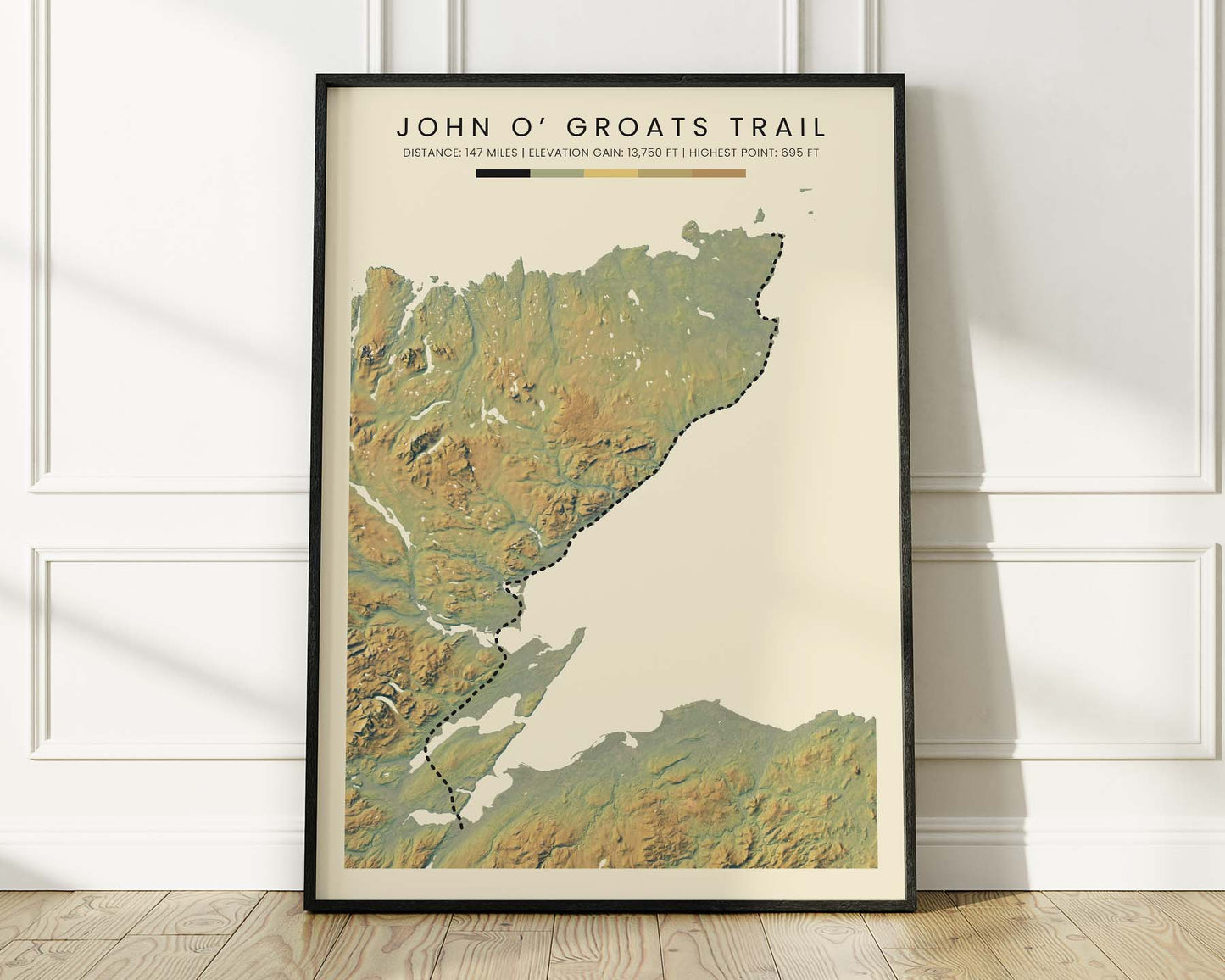
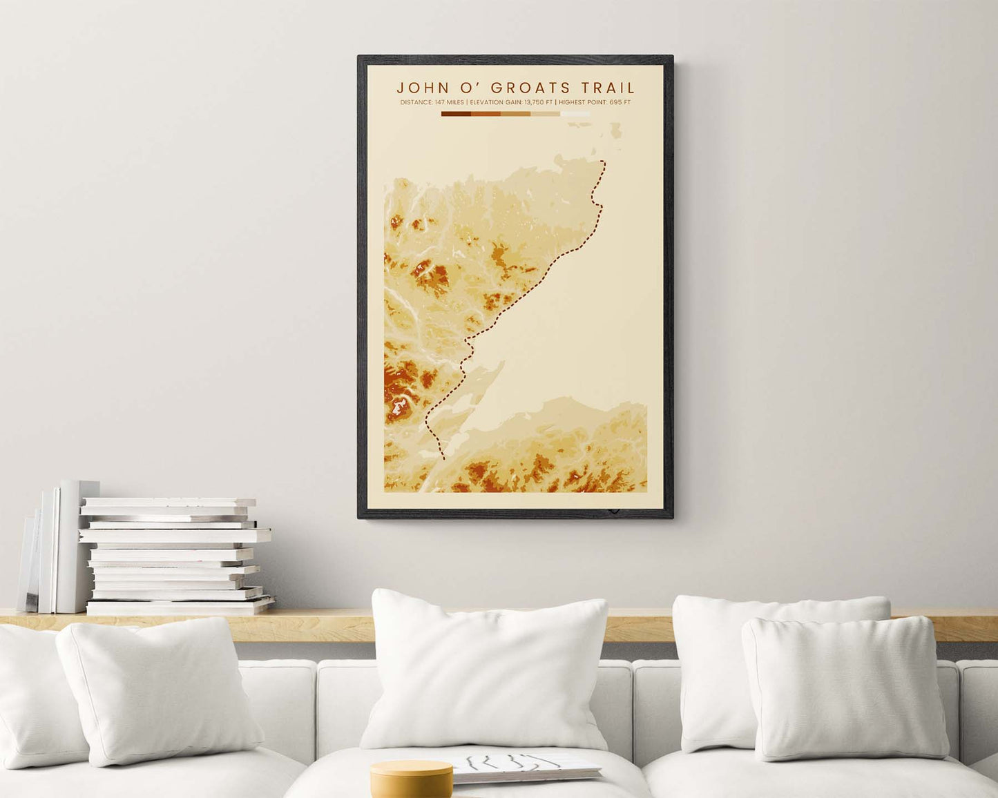


A topographic print of the John O' Groats Hiking Trail. It's made using open-source elevation data from NASA and features a colored contour map mixed with terrain hillshading. If you've completed it, then our poster will offer a great way of remembering this adventure.
About the John O' Groats Trail
The John O'Groats Trail is a coastal long-distance trail in Northern Scotland, in the United Kingdom. It starts at Inverness and then heads north along the eastern coastline to John O' Groats. Many people complete it every year because of the spectacular coastal scenery of the Scottish Highlands. Although it's mostly waymarked, some sections are considered to be fairly difficult.
Statistics About the John O'Groats Trail
- Start point: Inverness, United Kingdom
- End point: John o' Groats, United Kingdom
- Total distance: 147 miles / 236 km
- Total altitude gain/loss: 13 750 ft / 4191 m
- Highest point: 695 ft / 212 m
- Countries crossed: United Kingdom
- Time to finish: Usually 10 to 13 days

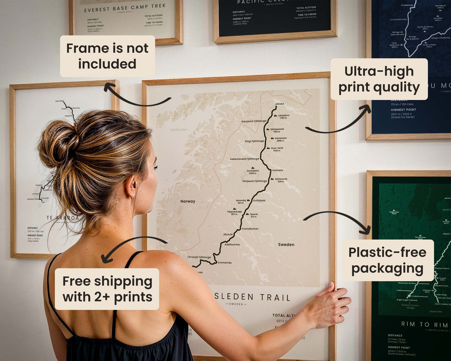
High Quality Matte Prints
Our posters are manufactured using ultra high definition printers with very rich and vivid colors. They're printed on thick, 189 g/m² matte paper sourced from Japan.

Plastic-Free Packaging
Our prints are shipped in cardboard triangles instead of typical tubes. This is better for the enviroment, because no plastic is used in the packaging.

The Right Size & Color for You
Our sizes are offered in imperical and metrical measurements, so it's easier for you to find the right frame locally.

Free Shipping With 2+ Posters
Save money by adding another poster to your cart (maybe as a gift for one of your friends or close relative), and get free shipping, even on international orders.

No Import Fees*
We have fulfillment locations in the United States, Canada, the United Kingdom, Spain, and Latvia. They're always manufactured from the closest one to your shipping address, so you can avoid paying import tax, get quicker deliveries, and reduce your carbon footprint.

30-day Satisfaction Guarantee
If, for whatever reason, you change your mind, we accept returns within 30 days of the delivery date.