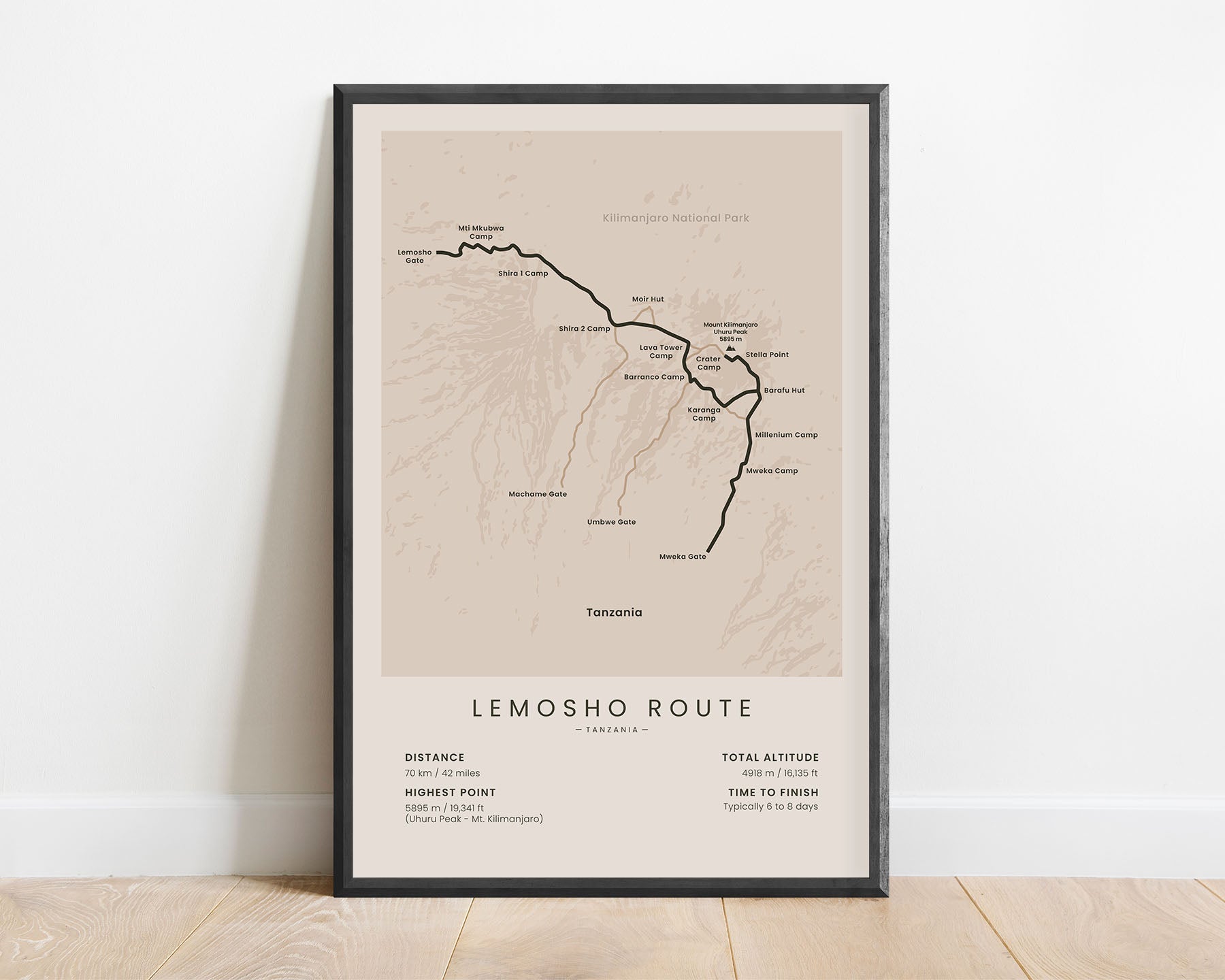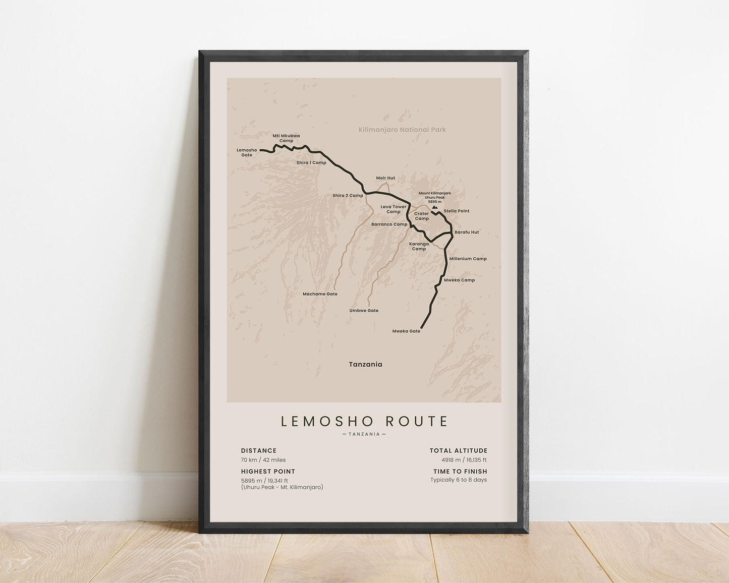
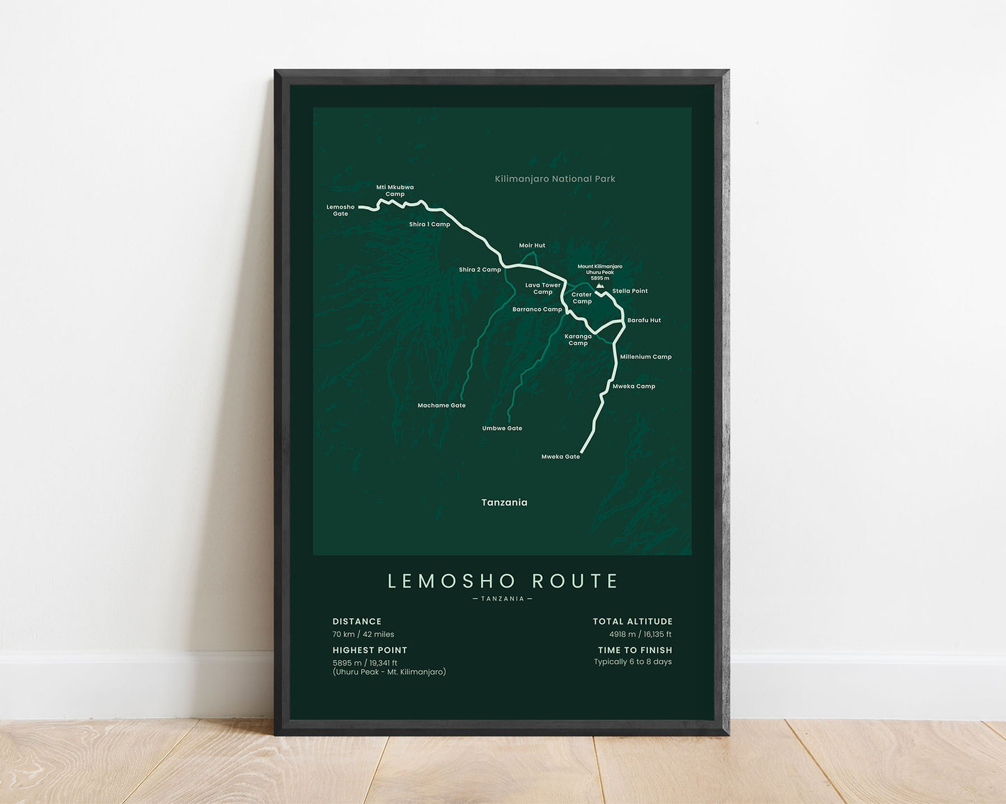
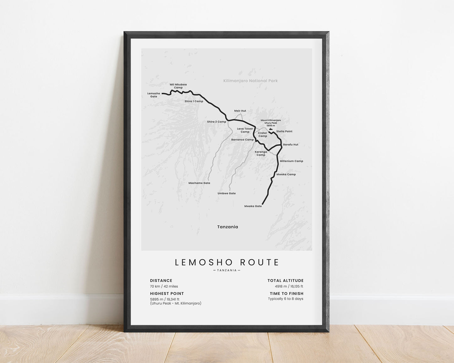
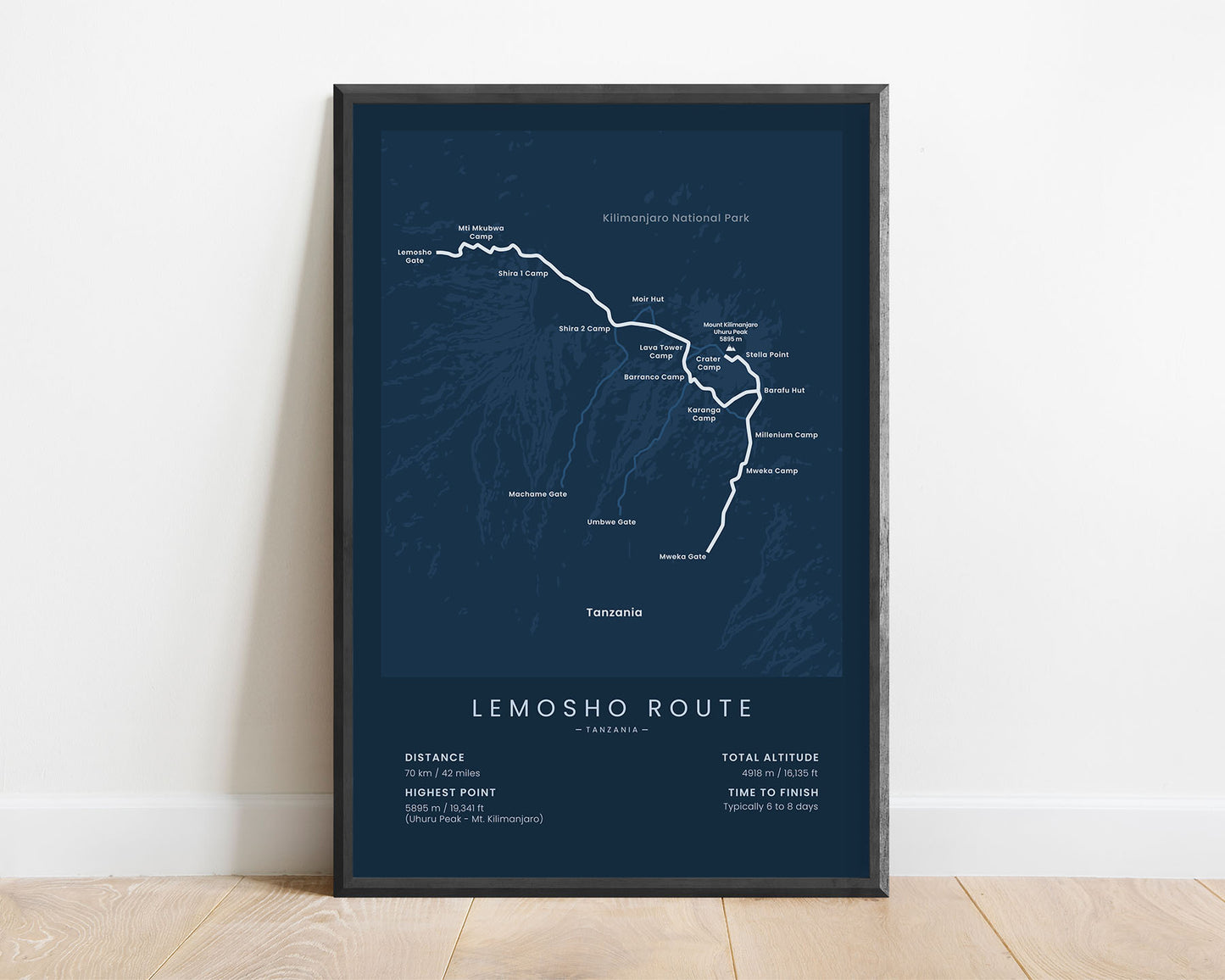
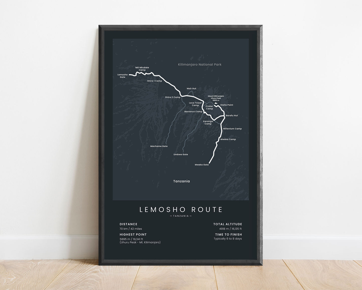


A minimalist print that shows the map of the Lemosho Route Mount Kilimanjaro summit trek. It includes the full route of the trail, main campsites, side trails, and a rough topographical map of the area. In addition to that, it also shows the main statistics about the hike, such as the total distance, elevation gain, highest point, and more.
About the Mount Kilimanjaro Lemosho Route
The Lemosho Route is one of the newest summit treks that goes up to Mount Kilimanjaro. It shares a big portion of the trail with the Machame route (other called Whiskey Route), but it starts at a different point - the Lemosho Glades. The Lemosho Route is one of the most beautiful of the Mount Kilimanjaro routes because it starts at the North-Western part of the mountain, which is much less frequently visited by tourists, and offers a chance to see more wildlife, rainforests, and more interesting landscape. It's also longer than the Machame route, which allows more days for acclimatization and a better chance of successfully completing the climb.
Statistics About the Lemosho Route
- Start point: Lemosho Gate, Tanzania
- End point: Mweka Gate, Tanzania
- Total distance: 70 km / 42 miles
- Total altitude gain/loss: 4918 m / 16 135 ft
- Highest point: 5895 m / 19 341 ft (Uhuru Peak - Mount Kilimanjaro)
- Countries crossed: Tanzania
- Time to finish: Usually 6 to 8 days
- Best time to hike: January - March

