


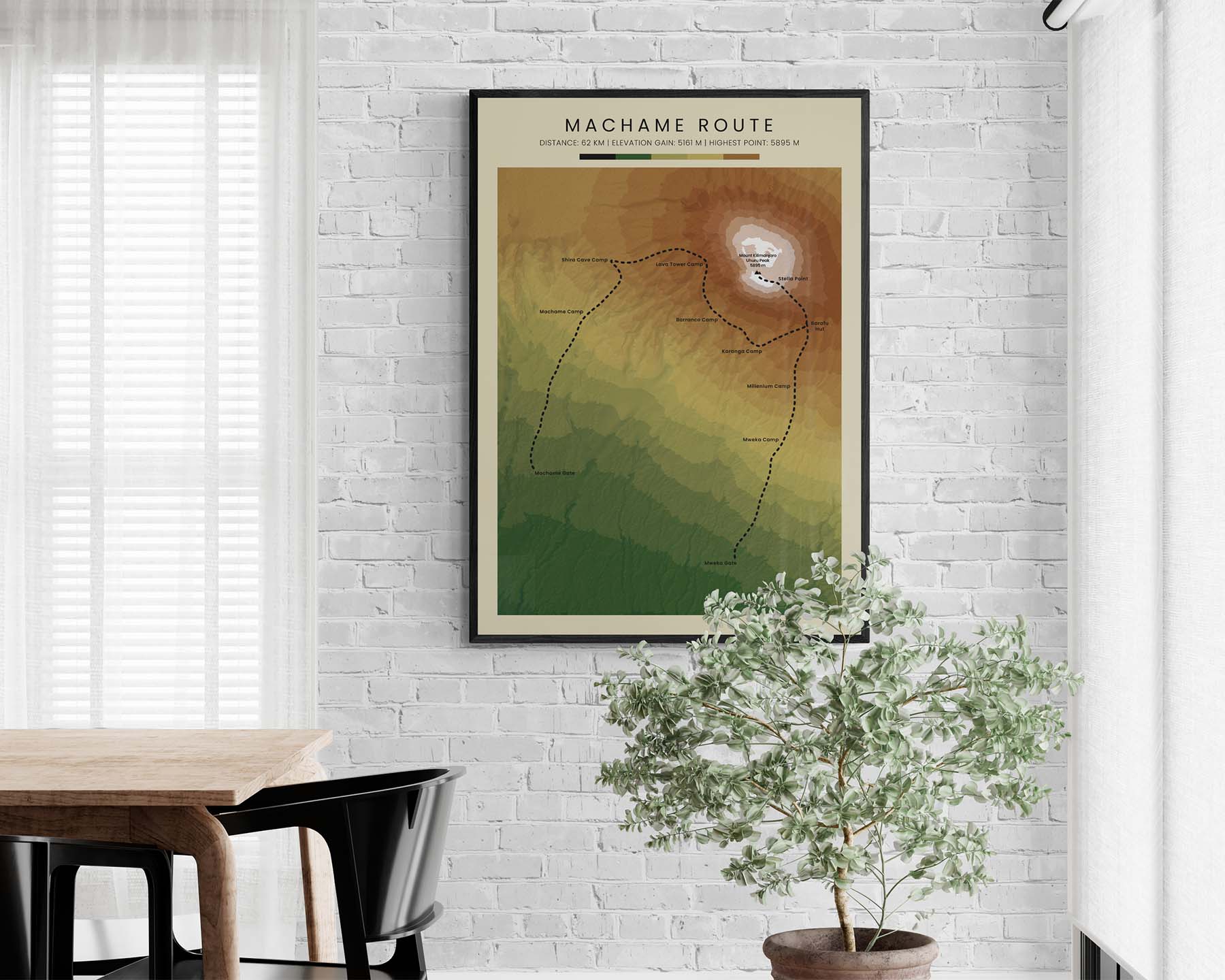


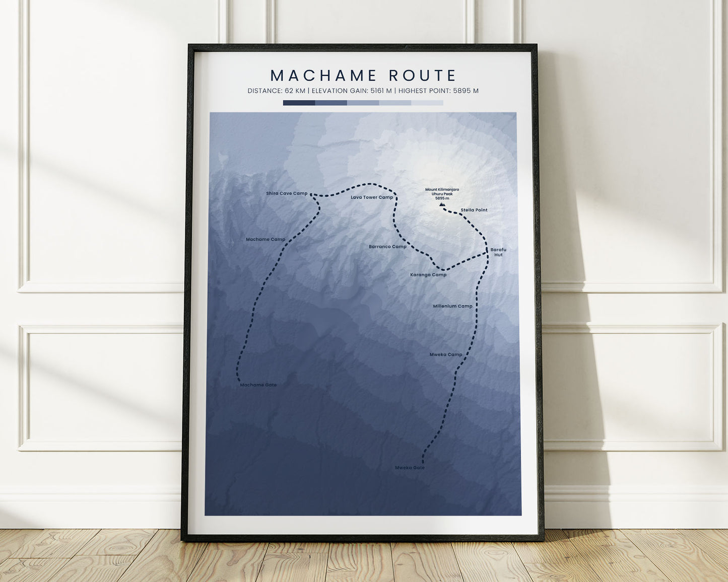
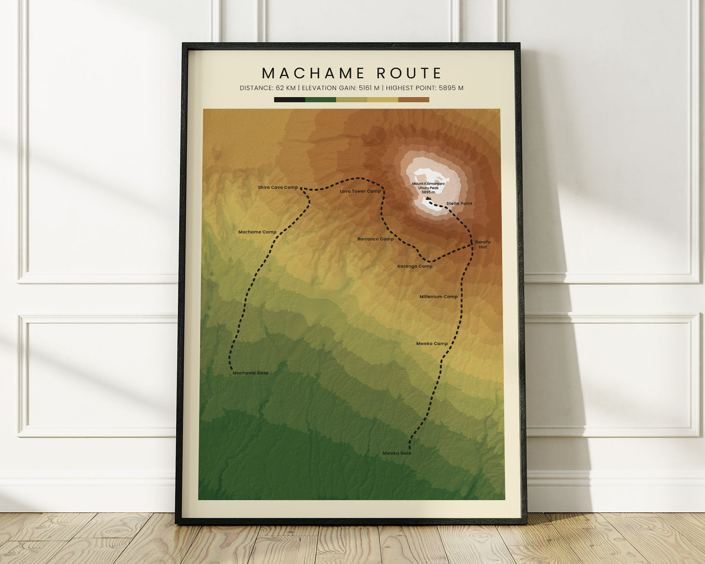
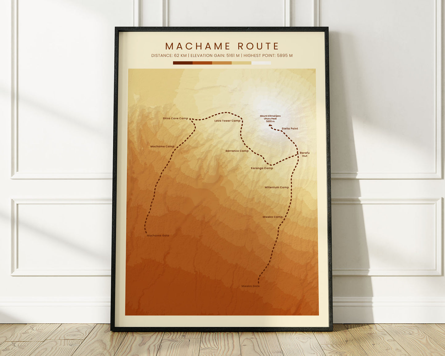


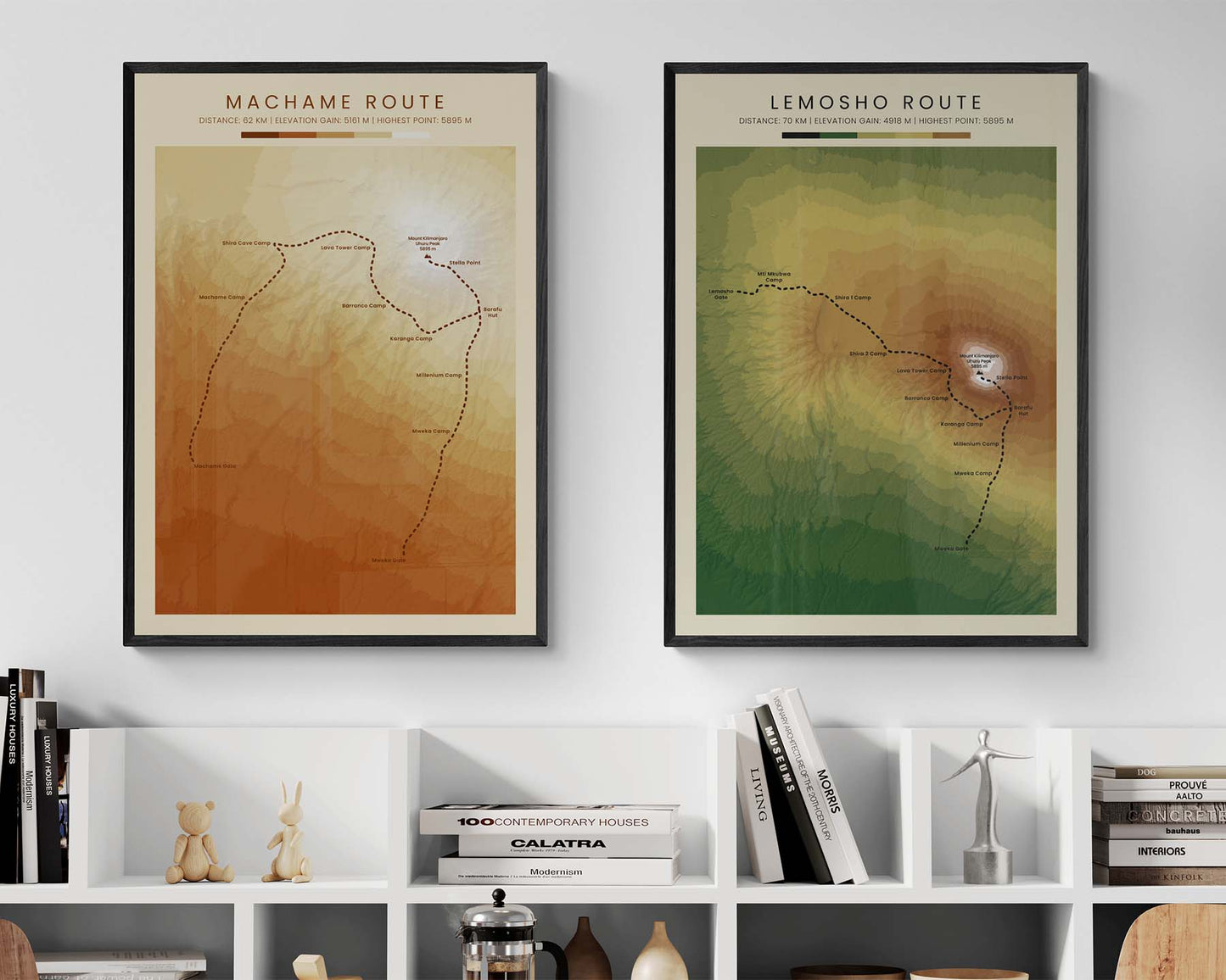
A topographic map poster of the Machame Route Trek that climbs up Mount Kilimanjaro. It's made using open-source satellite data from NASA and then transformed into beautiful artwork using complicated software. We're offering it in three options: minimalistic, vintage, and realistic, to look good in modern, minimalistic, and cozy interiors. If you have a friend or partner who has completed this trek, then this print can be a great gift idea for a special occasion.
About the Mount Kilimanjaro Machame Route
Machame Route, also called the Whiskey Route, is a popular trek in Tanzania that summits Mount Kilimanjaro. It's notable because Kilimanjaro is the highest mountain peak in mainland Africa. The Machame Route is usually completed in several days and requires proper acclimatization for most hikers due to altitude concerns.
Statistics About the Machame Route
- Start point: Machame Gate, Mount Kilimanjaro Natural Park, Tanzania
- End point: Mweka Gate, Mount Kilimanjaro Natural Park, Tanzania
- Total distance: 62 km / 37 miles
- Total altitude gain/loss: 5161 m / 16 932 ft
- Highest point: 5896 m / 19 341 ft (Uhuru Peak - Mount Kilimanjaro)
- Countries crossed: Tanzania
- Time to finish: Usually 6-7 days