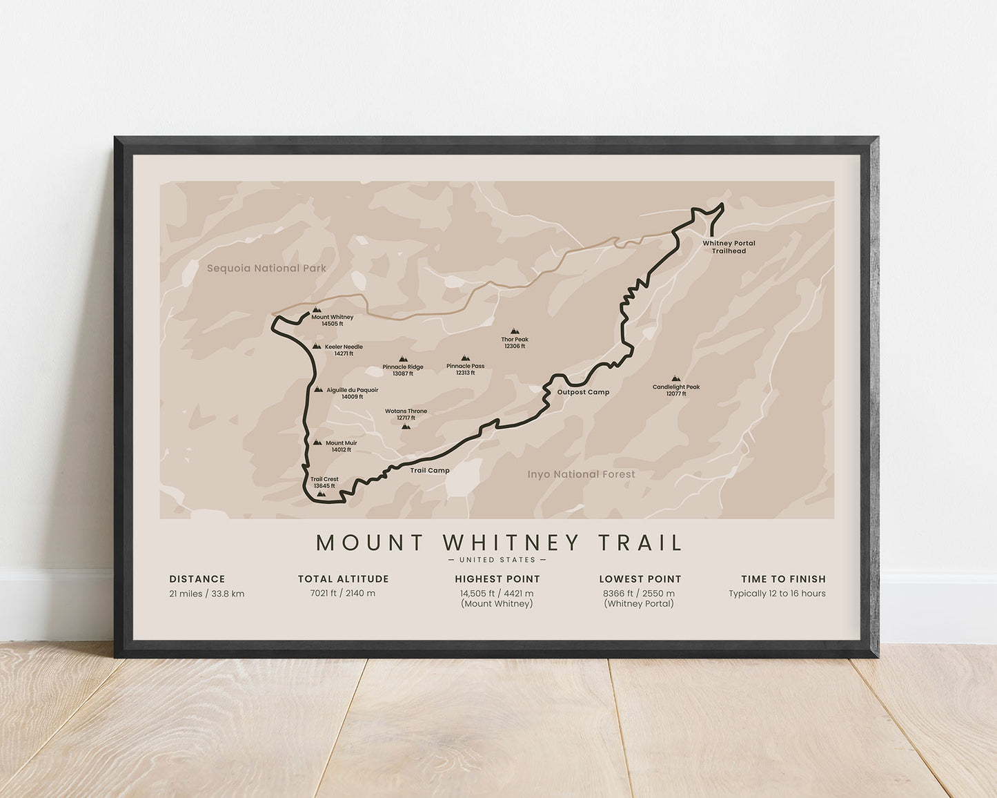
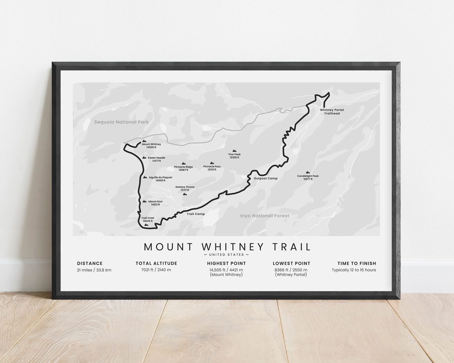
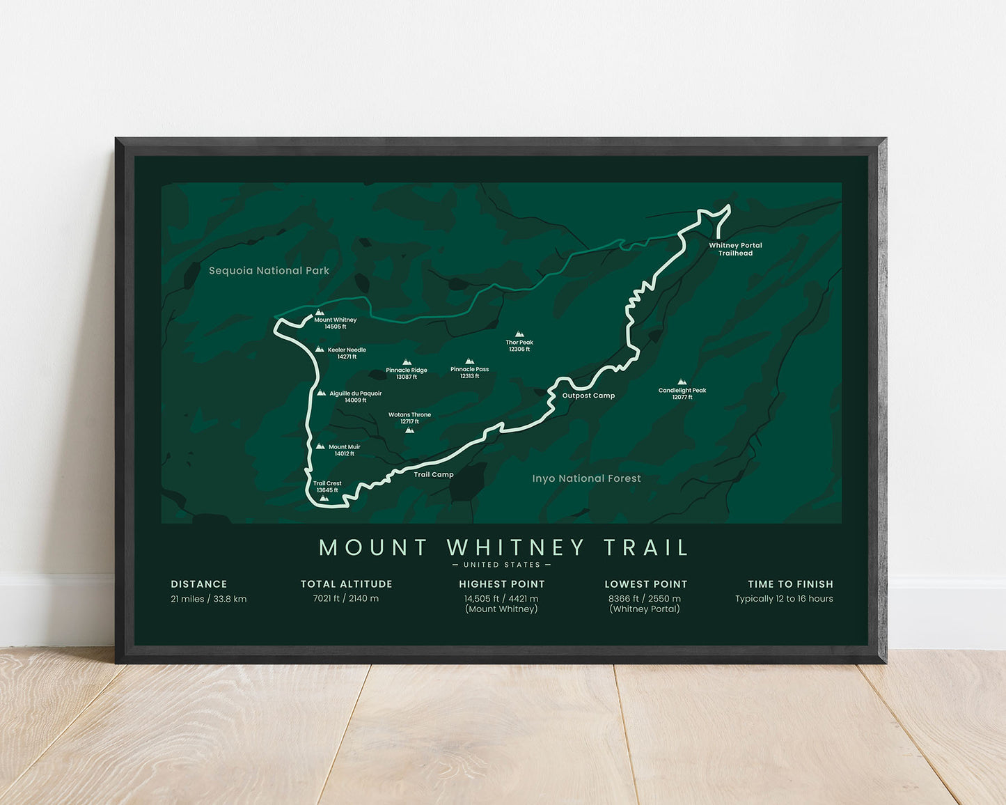
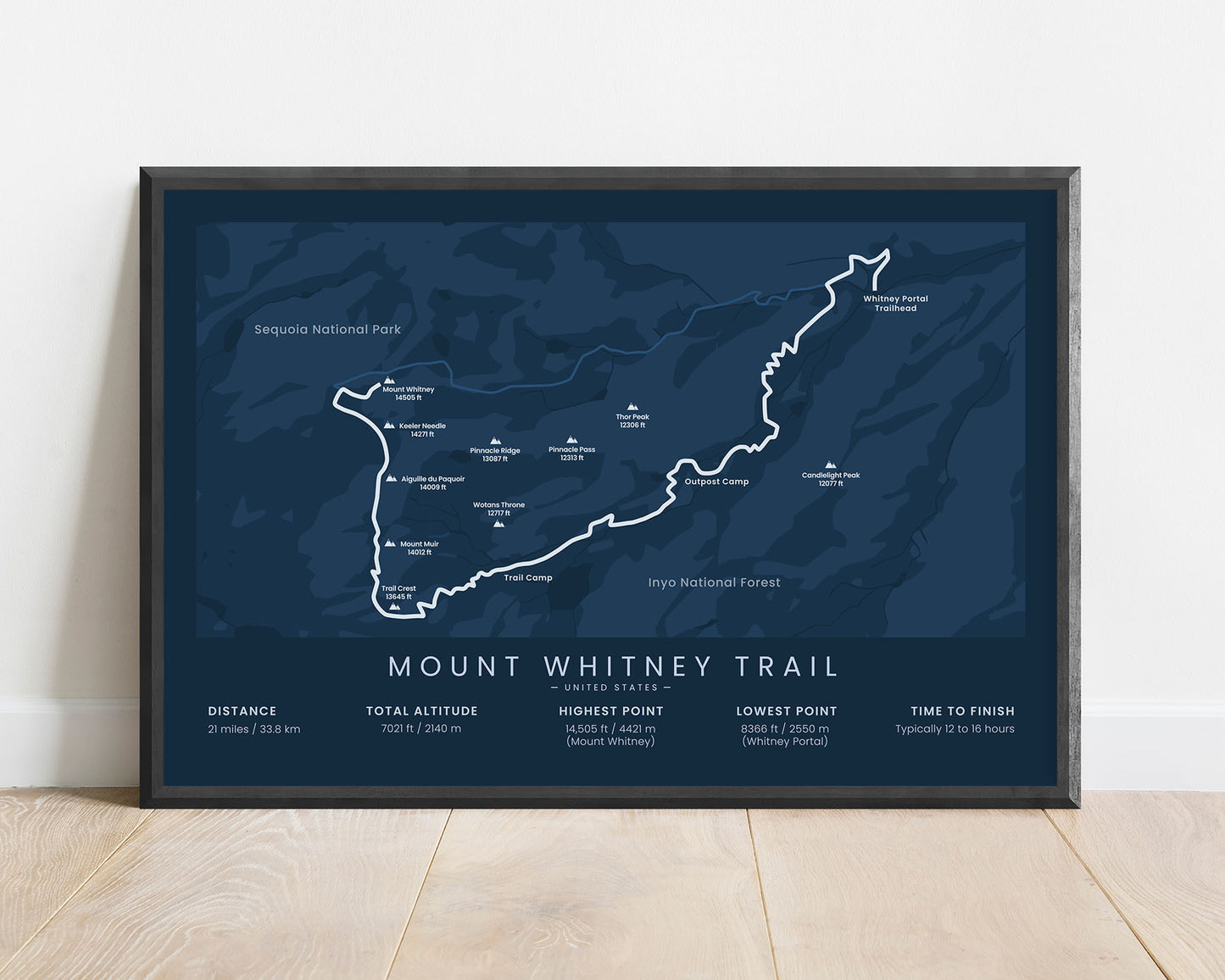
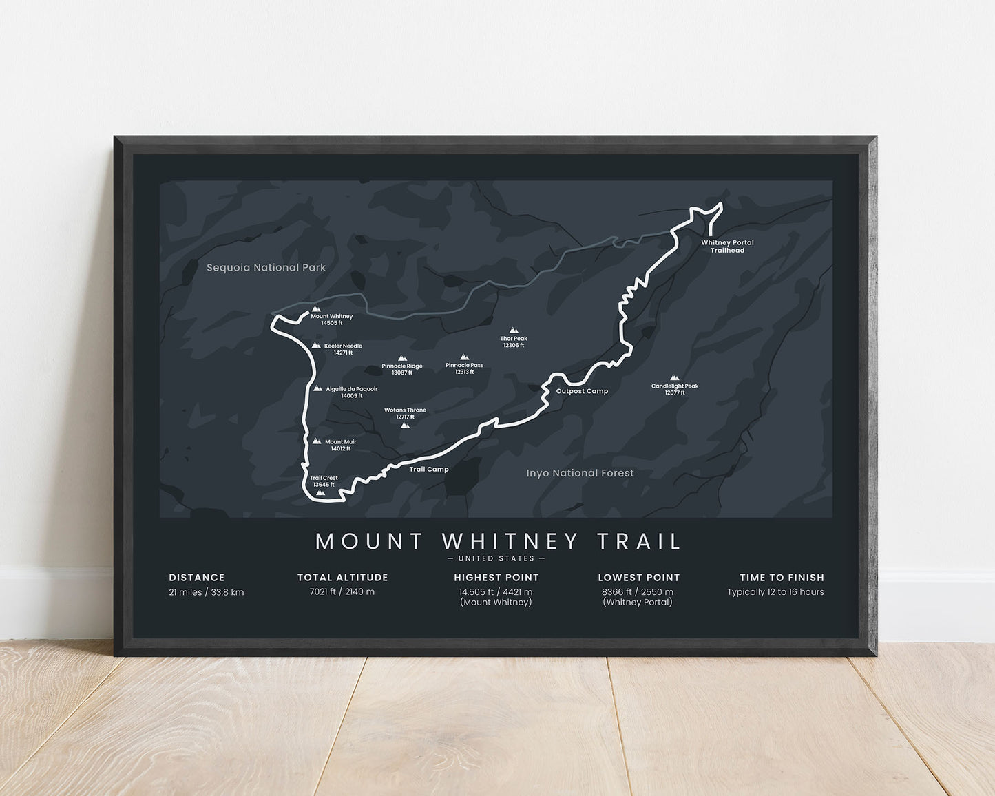

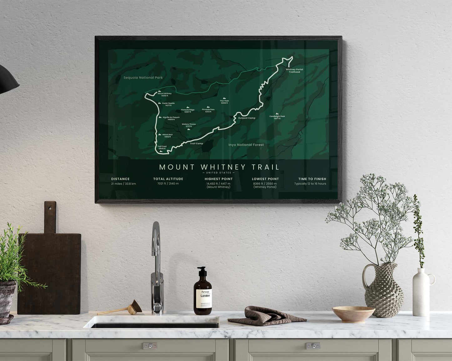

A poster that displays the map of the Mount Whitney Summit Hike in California, United States. In this print, you’ll find a map of the full hike, starting at Whitney Portal and ending at the Mount Whitney Summit. In this map, you’ll also find other important peaks along the way, the main lakes and lagoons, the main points of interest, and important statistics about the trail at the bottom. If you’ve finished this trail or know someone else who has, then it will be a great way to remember your adventure.
About The Mount Whitney Trail
The Mount Whitney Trail (other called Mt Whitney Hike or Mt Whitney Summit) is a popular single-day hiking trail in the Sierra Nevada mountain range, in California, United States. It starts at the Whitney Portal Trailhead, then summits Mount Whitney, the highest mountain peak in the United States, and then heads back down the same route. This trail is usually completed in the summer when the snow has melted and the conditions of the trail have improved. When hiking this trail, you'll experience magnificent views of the Inyo National Forest, the Sequoia National Park, and the highest nearby mountain peaks. This is a part of the John Muir Trail, which ends at the same point, only takes much longer to finish (210 miles).
Statistics About the Mount Whitney Hike
- Start/End point: Whitney Portal Trailhead, California, United States
- Total distance: 21 miles / 33.8 km
- Total altitude gain/loss: 7021 ft / 2140 m
- Highest point: 14 505 ft / 4421 m (Mount Whitney)
- Points of interest: Mount Whitney, Whitney Portal, Sierra Nevada, Outpost camp, Trail Camp, Mount Muir, Keeler Needle, Sequoia National Park, Inyo National Forest
- Time to finish: Typically 12 to 16 hours


