


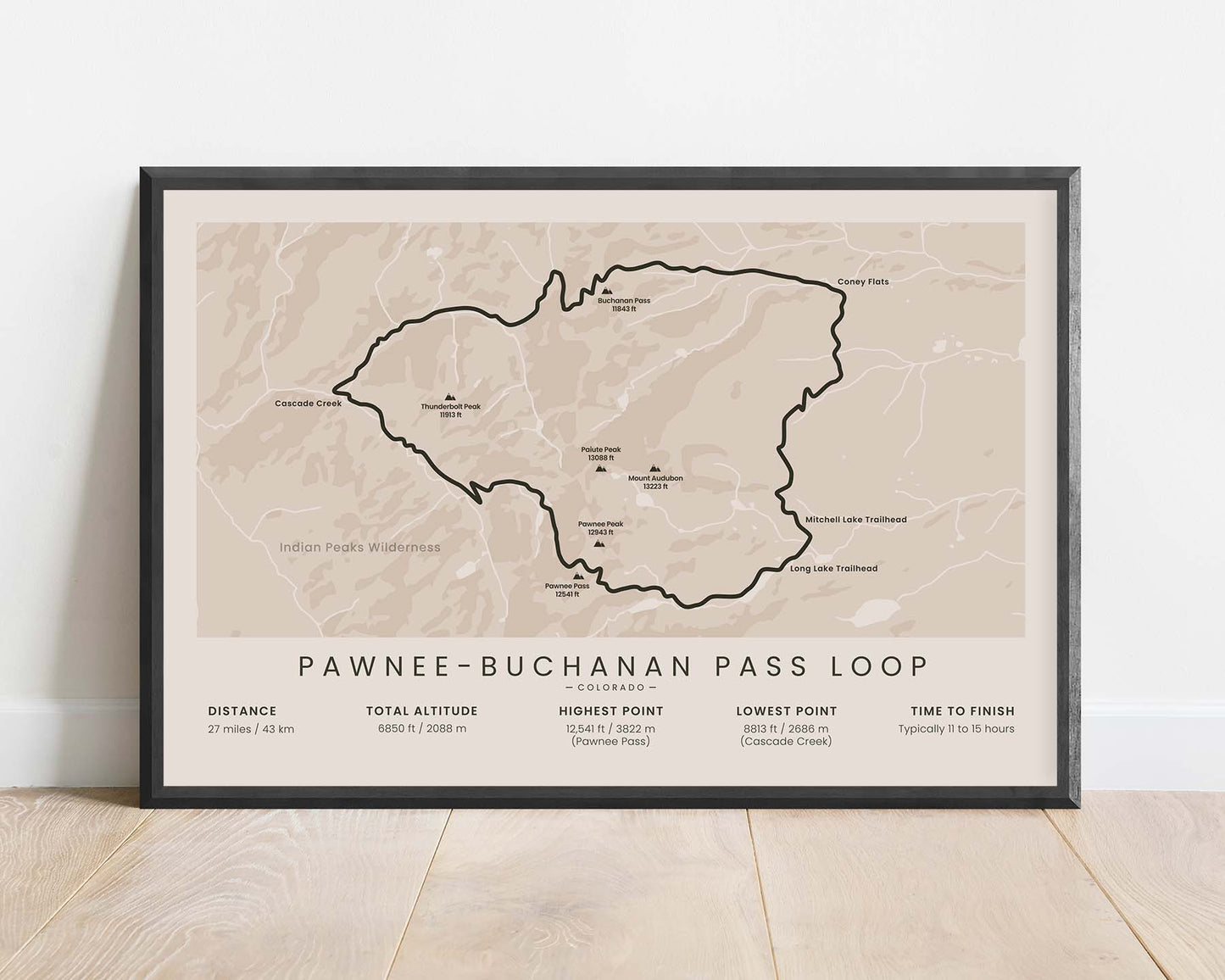
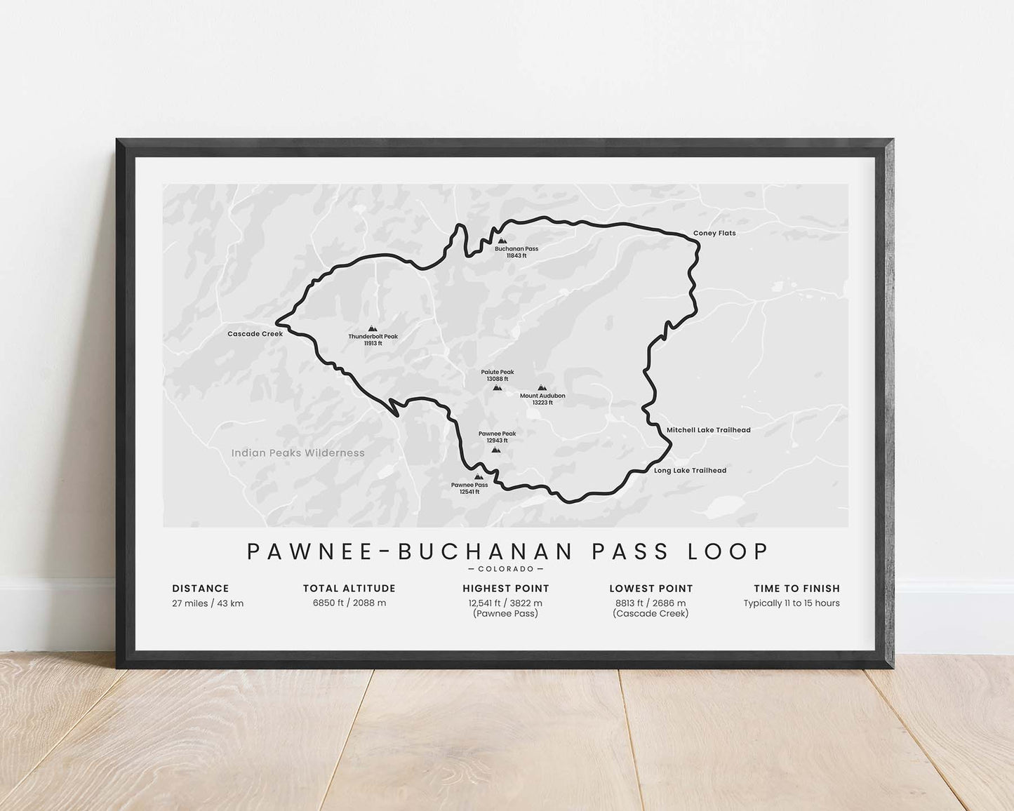
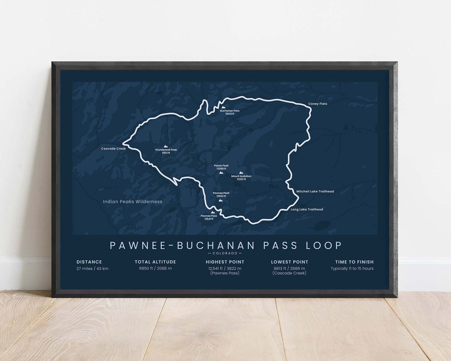
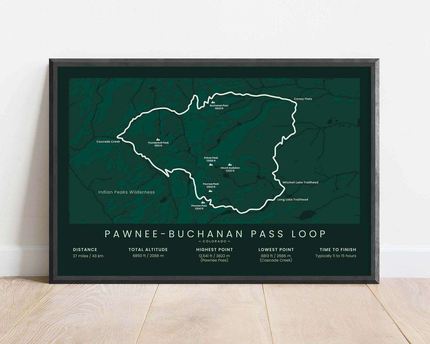


A minimalistic print of the Pawnee-Buchanan Loop hiking trail in the Indian Peaks Wilderness, Colorado.
About the Northern Indian Peaks Loop
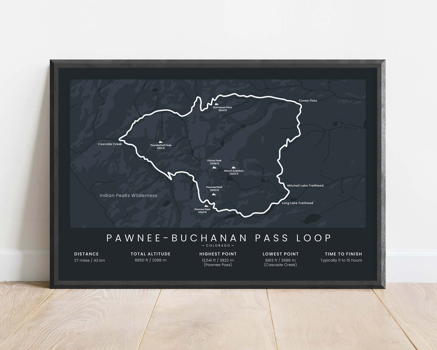
The Pawnee-Buchanan Loop, other called the Northern Indian Peaks Loop or the Double Bypass Loop, is a popular multi-day loop in the Indian Peaks Wilderness, Colorado, United States. It's one of the most spectacular multi-day hikes in Colorado, as it includes passing through countless alpine meadows, along pristine-clear rivers and waterfalls, spectacular views of the mountains, and encountering a lot of local animals and plants. The trail itself is well-marked, but some sections of the trail could be considered fairly difficult
Statistics About the Pawnee-Buchanan Loop
- Start and End point: Mitchell Lake Trailhead
- Total distance: 27 miles / 43 km
- Total altitude gain/loss: 6850 ft / 2088 m
- Highest point: 12,541 ft / 3822 m (Pawnee Pass)
- Lowest point: 8813 ft / 2686 m (Cascade Creek)
- Time to finish: Typically 11 to 15 hours
- States crossed: Colorado