


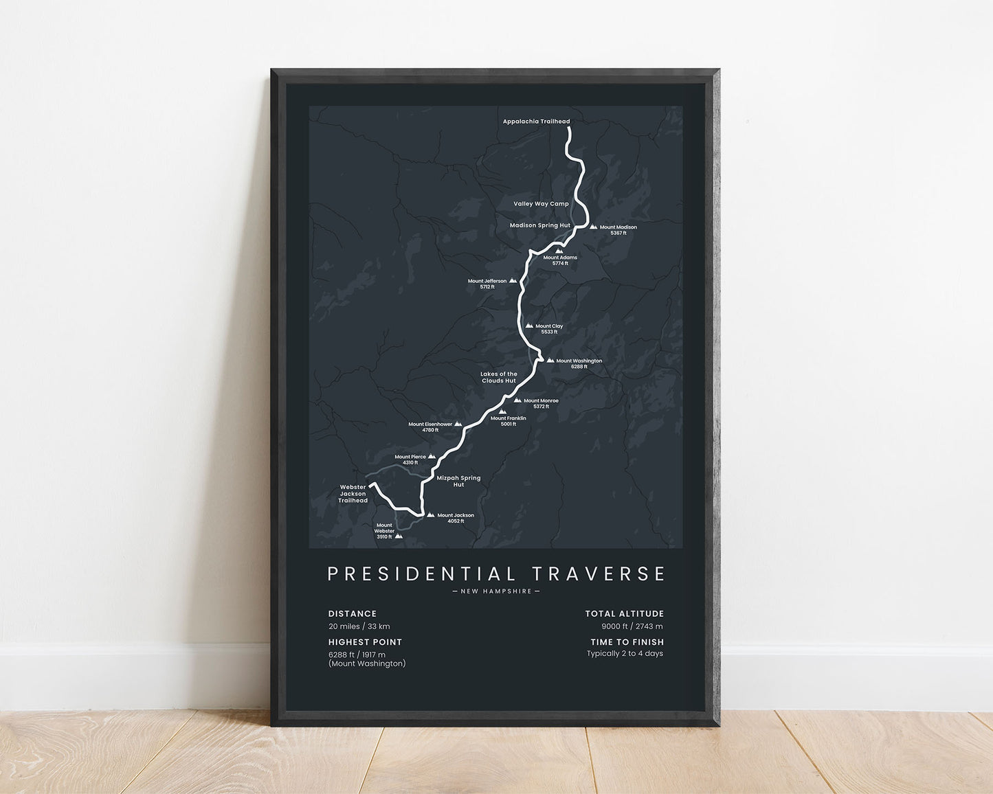
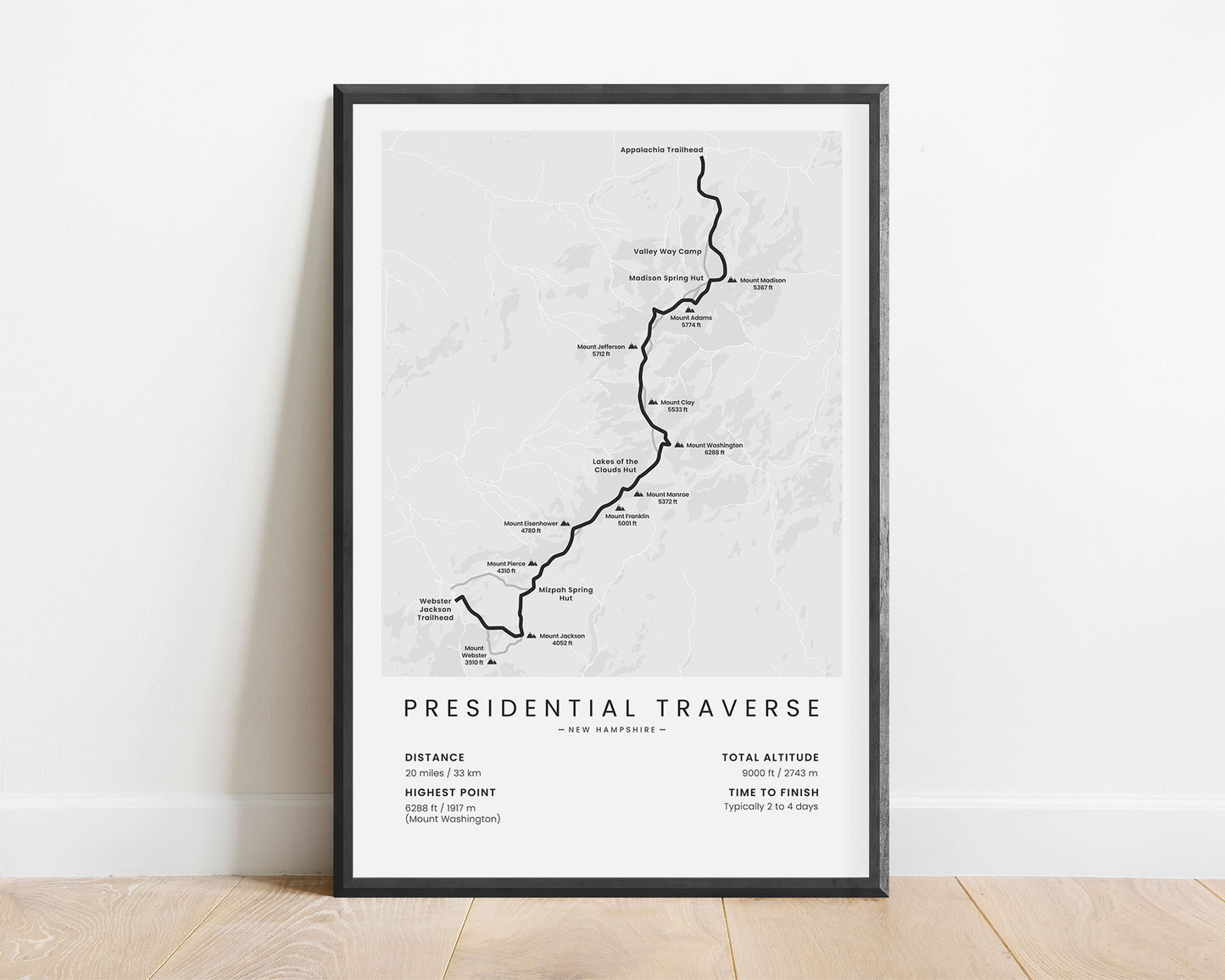
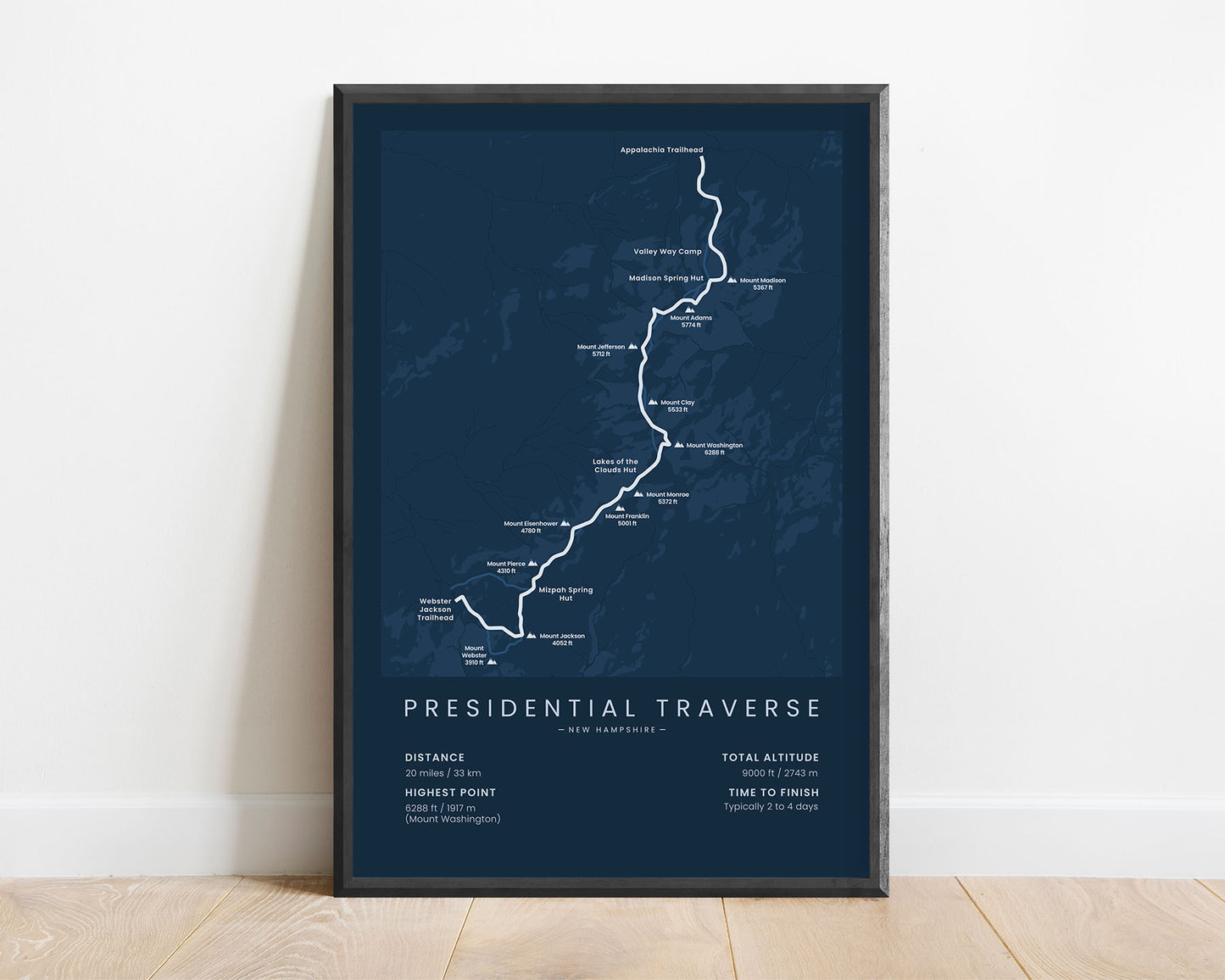
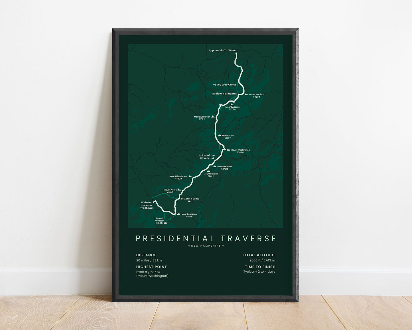


A map of the Presidential Traverse trek in the White Mountains, New Hampshire. This poster details the full route of the trail, the highest summited peaks, a rough topographical map of the area, and the main points of interest along the way.
About the Presidential Traverse
The Presidential Traverse is a popular trek in the White Mountains, New Hampshire, United States. It stretches 23 miles across the highest peaks of the Presidential Mountains and offers some spectacular scenery of the surrounding area - including rocky, exposed ridges, high summits, alpine meadows, and high-elevation forests. It's considered a fairly difficult trek because the Presidental Mountains are notorious for sudden weather changes, leaving unprepared hikers exposed and in danger. Most of the hike goes above the treeline and doesn't have good water sources, so most people finish it within a single day, but with enough supplies, it can also be completed in 2 to 4 days. A part of the trail also follows the Appalachian Trail.
Statistics About the Presidential Traverse
- Start point: Appalachia Trailhead, New Hampshire, United States
- End point: Webster Jackson Trailhead, New Hampshire, United States
- Total distance: 20 miles / 33 km
- Total altitude gain/loss: 9000 ft / 2743 m
- Highest point: 6288 ft / 1917 m (Mount Washington)
- Peaks summited: Mount Madison (5367 ft), Mount Adams (5774 ft), Mount Jefferson (5712 ft), Mount Clay (5533 ft), Mount Washington (6288 ft), Mount Monroe (5384 ft), Mount Franklin (5001 ft), Mount Eisenhower (4780 ft), Mount Pierce (4310 ft), and Mount Jackson (4052 ft)
- Points of interest: the White Mountains, Presidential Mountains, Great Gulf Wilderness, Presidential Range - Dry River Wilderness
- Time to finish: Typically 2 to 4 days