


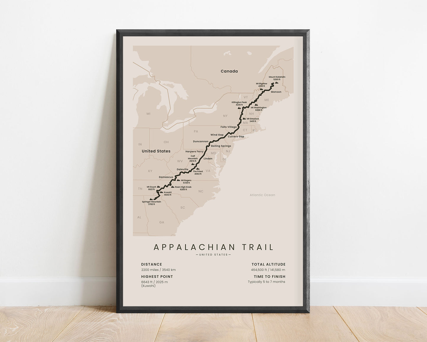

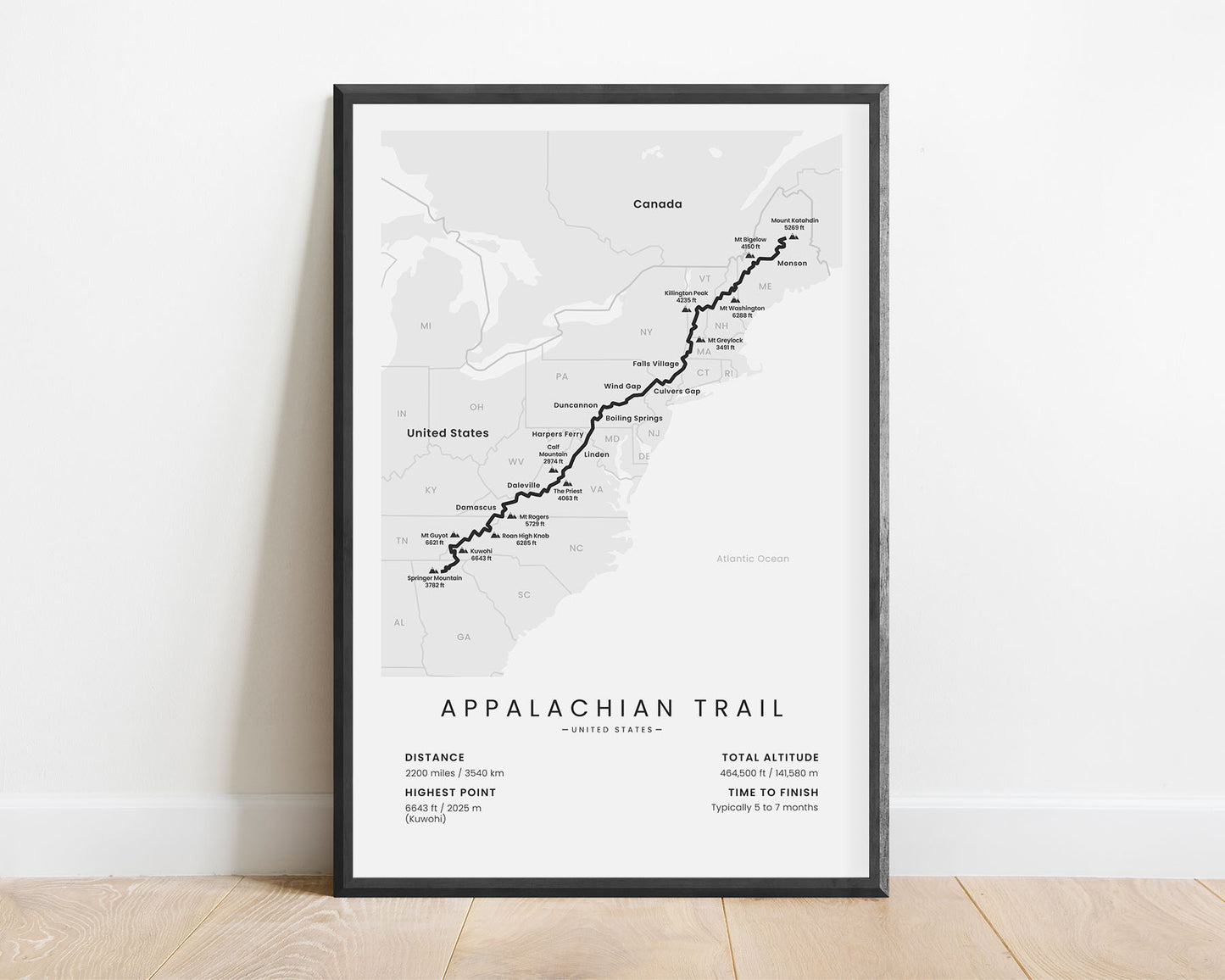
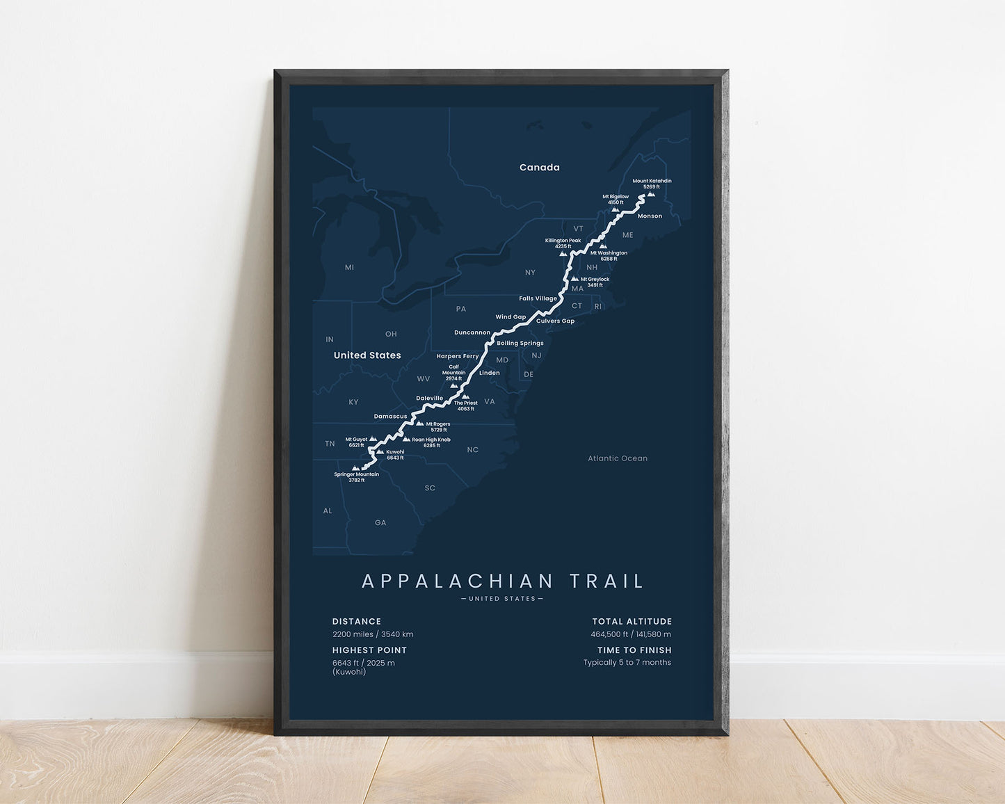


A minimalist map of the Appalachian National Scenic Trail, which includes the full route of the thru-hike. At the bottom, it also shows other important statistics, like the total distance, altitude, and more. When framed, it will fit into most Scandinavian and minimal bedrooms, living rooms, hallways, and other rooms.
About the Appalachian Trail Thru-Hike
The Appalachian National Scenic Trail (in short - AT) is a long-distance trail in the US, which starts at Springer Mountain, Georgia, and ends at Mount Katahdin, Maine. It's one of 11 National Scenic Trails, which essentially are long-distance trails (longer than 100 miles) in the United States with outstanding natural scenery. It's one of the most popular thru-hikes in the US, and also one of the oldest - the waymarking of the Appalachian Trail started back in 1921. Together with the Pacific Crest Trail and Continental Divide Trail, people unofficially label these three trails as the "Triple Crown of hiking". It also shares roughly 100 miles with the Vermont Long Trail and another section with the Pinhoti Trail. Generally, the AT goes through forests and meadows, instead of mountain peaks, and hikers encounter a lot of rain during the thru-hike. Usually, people complete the whole trail in a few months, but it should be started early to reduce the chances of being interrupted by an early winter season.
Statistics About the Appalachian Hiking Trail
- Start point: Southern Terminus, Springer Mountain, Georgia
- End point: Northern terminus, Mount Katahdin, Maine
- Total distance: 2200 miles / 3540 km
- Total altitude gain/loss: 464 500 ft / 141 580 m
- Highest point: 6643 ft / 2025 m (Kuwohi)
- Countries crossed: United States
- States Crossed: Georgia, North Carolina, Tennessee, Virginia, West Virginia, Maryland, Pennsylvania, New Jersey, New York, Connecticut, Massachusetts, Vermont, New Hampshire, Maine
- Time to finish: Usually 5 to 7 months
- Best time to hike: March - October