


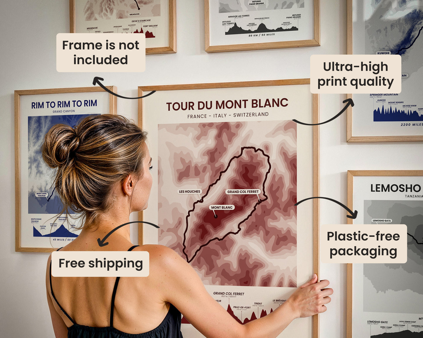
A topographic print of the Tour Du Mont Blanc long-distance hike. It shows an elevation contour map of the area around Mont Blanc as well as an elevation profile of the hike at the bottom, along with some important points of interest.
About the Mont Blanc Loop
The Tour du Mont Blanc - often called the TMB, Mont Blanc Loop, or Ultra Tour du Mont Blanc - is one of Europe’s most celebrated long-distance hiking trails. Circling Mont Blanc, the highest peak in Western Europe, the route winds through spectacular alpine landscapes across France, Italy, and Switzerland. Over roughly 170 kilometers, hikers experience dramatic glaciers, wildflower meadows, high mountain passes, and charming alpine villages. Typically completed in 7–11 days, the TMB is renowned for its well-marked paths, welcoming mountain refuges, and deep mountaineering heritage. Its blend of cultural diversity, breathtaking scenery, and physical challenge has made it one of the most iconic multi-day treks in the world.
Statistics About the Tour du Mont Blanc Trail
- Start and end point: Les Houches, France
- Total distance: 165 km / 103 miles
- Total altitude gain/loss: 10,583 m / 34,721 ft
- Highest point: 2537 m / 8323 ft (Grand Col Ferret)
- Countries crossed: France, Switzerland, Italy
-
Time to finish: Typically 9 to 12 days

High Quality Matte Prints
Our posters are manufactured using ultra high definition printers with very rich and vivid colors. They're printed on thick, 189 g/m² matte paper sourced from Japan.

Plastic-Free Packaging
Our prints are shipped in cardboard triangles instead of typical tubes. This is better for the enviroment, because no plastic is used in the packaging.

The Right Size & Color for You
Our sizes are offered in imperical and metrical measurements, so it's easier for you to find the right frame locally.

Free Shipping With 2+ Posters
Save money by adding another poster to your cart (maybe as a gift for one of your friends or close relative), and get free shipping, even on international orders.

No Import Fees*
We have fulfillment locations in the United States, Canada, the United Kingdom, Spain, and Latvia. They're always manufactured from the closest one to your shipping address, so you can avoid paying import tax, get quicker deliveries, and reduce your carbon footprint.

30-day Satisfaction Guarantee
If, for whatever reason, you change your mind, we accept returns within 30 days of the delivery date.