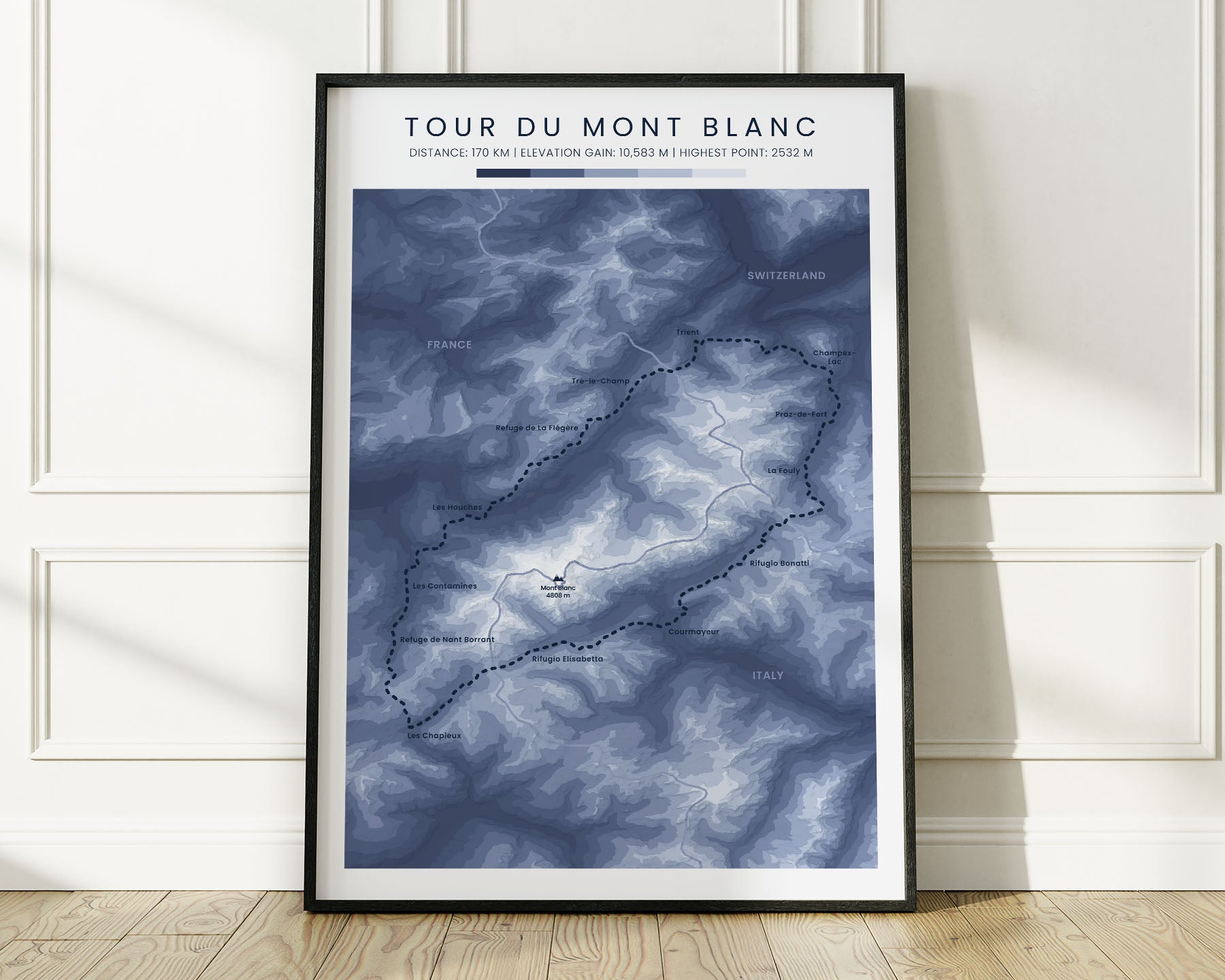


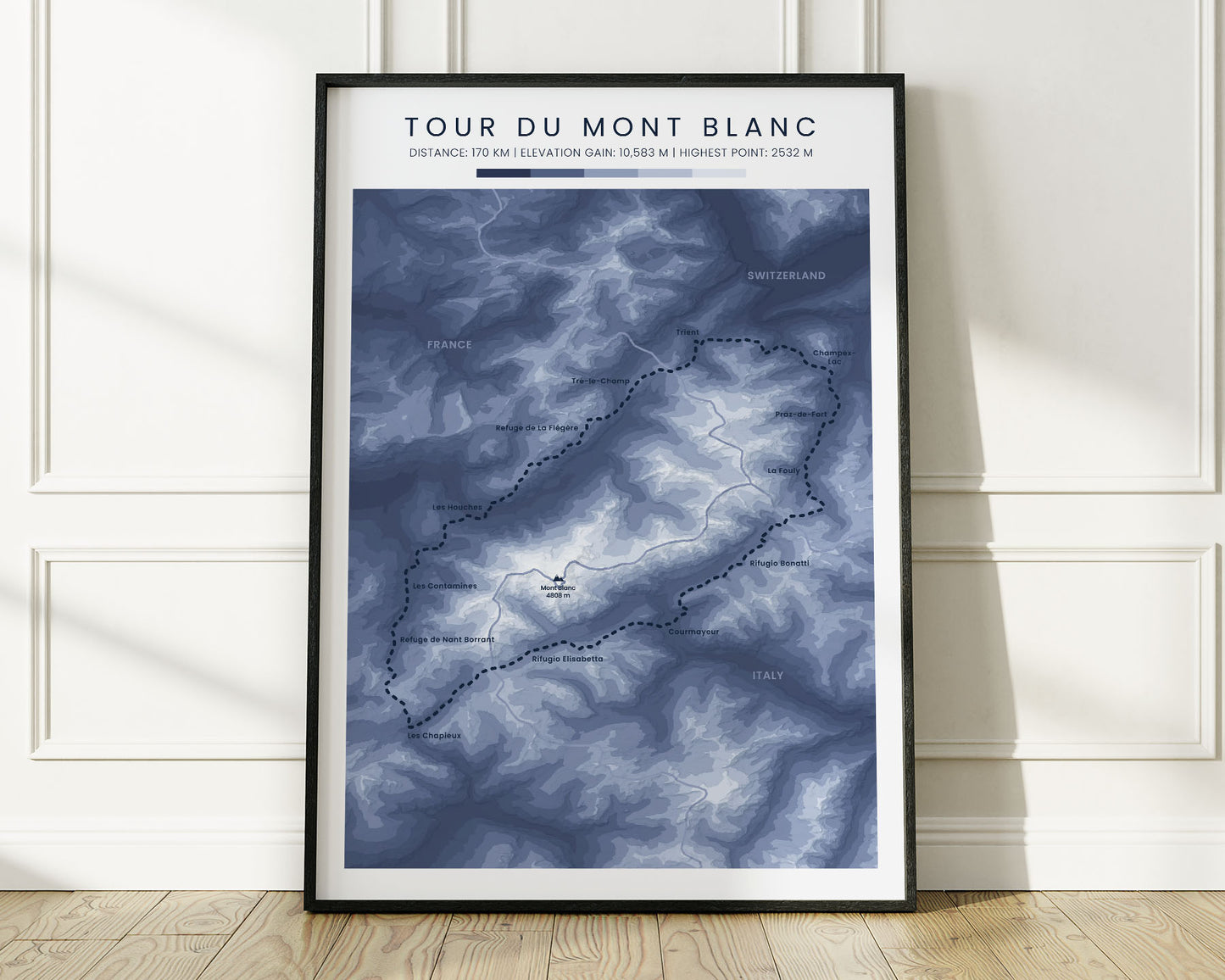
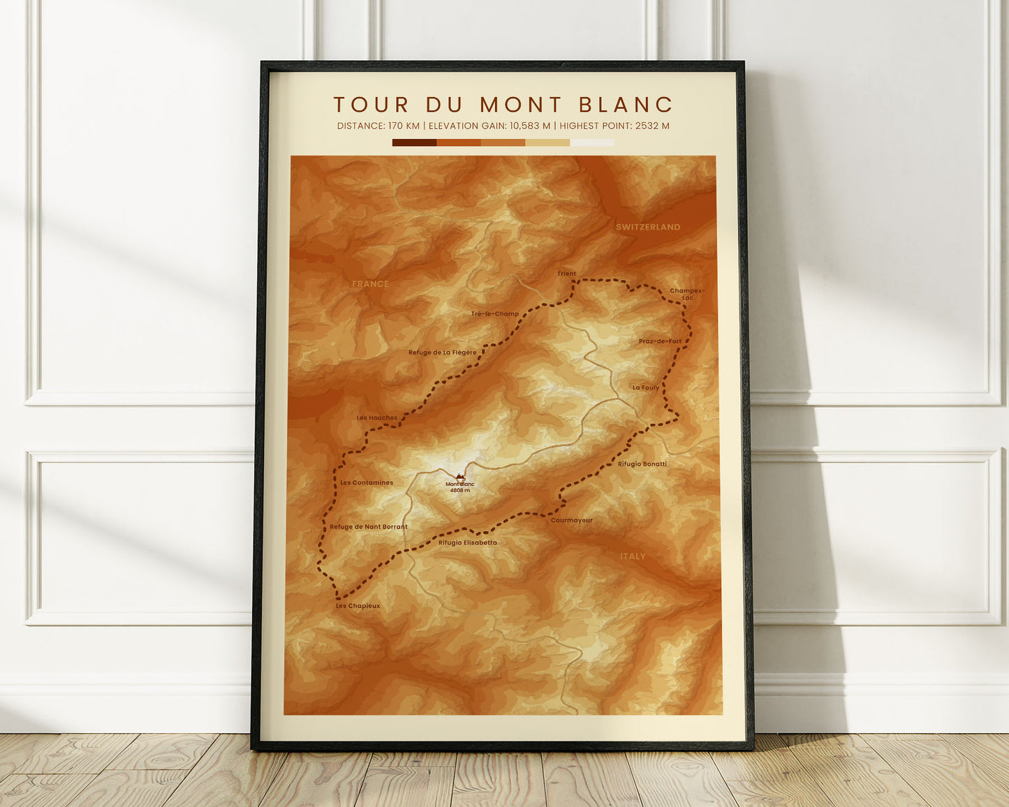
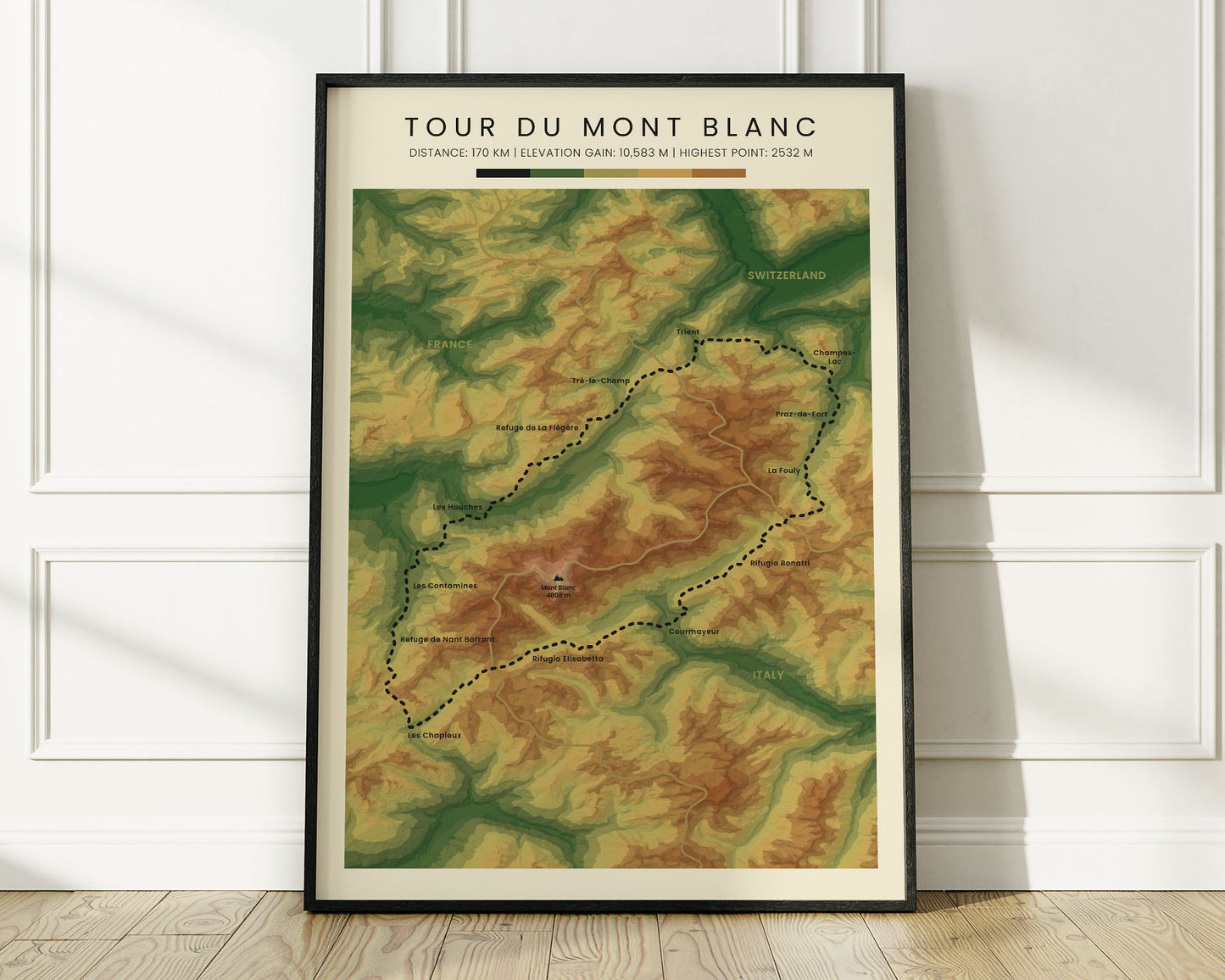


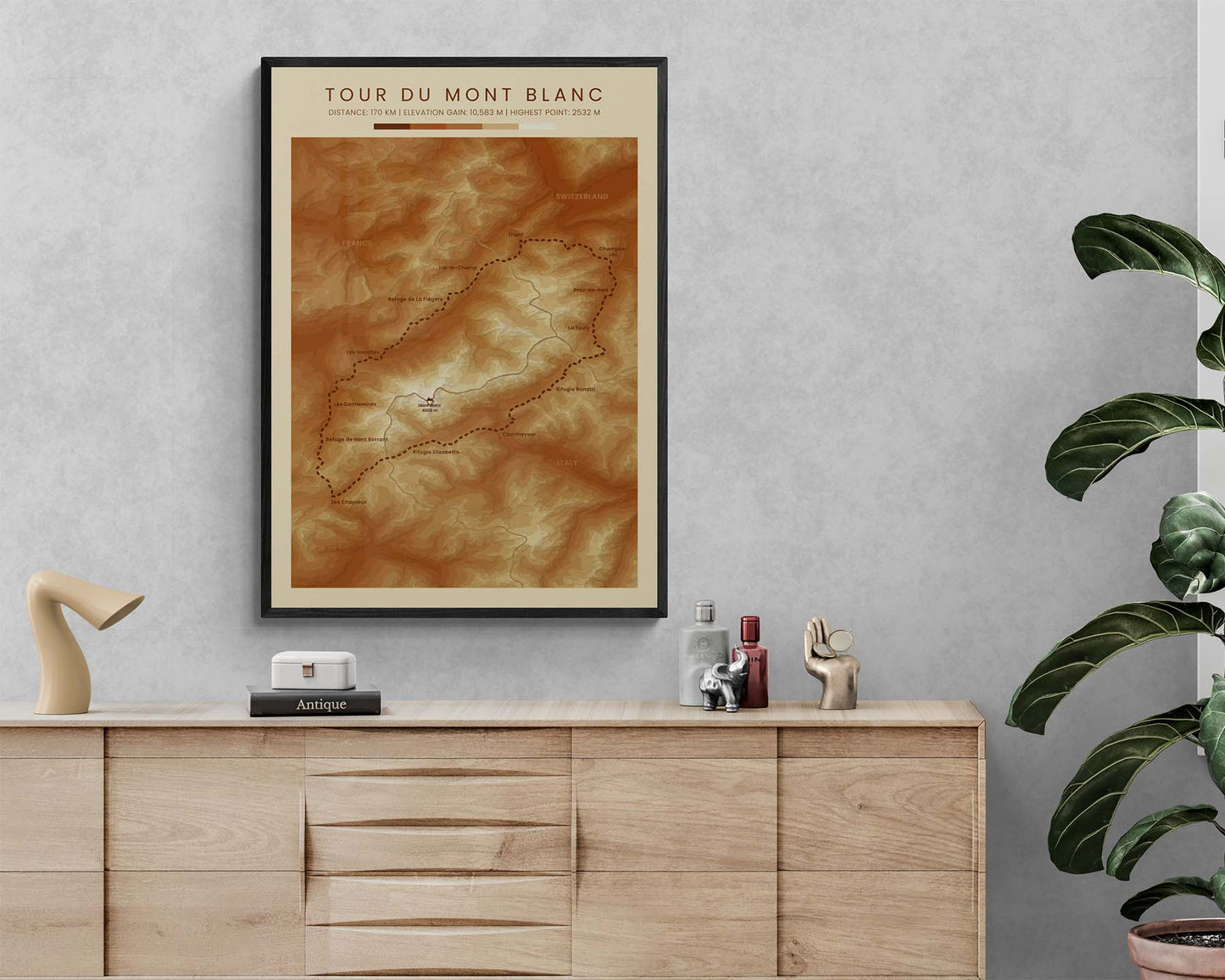
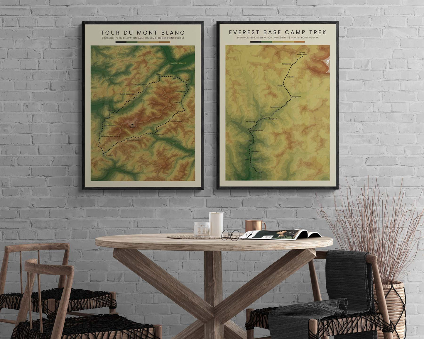
A poster that shows a topographic map of the Tour du Mont Blanc hiking trail. It's offered in three different color options to look good in minimalistic, modern, and rustic interiors. This elevation contour map is the perfect gift for someone who has completed the Tour du Mont Blanc.
About the Tour Du Mont Blanc Trek
Tour du Mont Blanc, also called Mont Blanc Loop, Ultra Tour du Mont Blanc, or simply TMB, is a popular hiking trail in the Alps, Europe. It loops around Mont Blanc - the highest mountain peak in Europe. The trail passes through pristine alpine scenery in France, Italy, and Switzerland. It's one of the most popular multi-day hikes in Europe.
Statistics About the Tour Du Mont Blanc Trail
- Total distance: 170 km / 106 miles
- Total altitude gain/loss: 10 583 m / 34 721 ft
- Highest point: 2532 m / 8307 ft (Grand Col Ferret)
- Countries crossed: France, Switzerland, Italy
- Time to finish: Usually 9-12 days